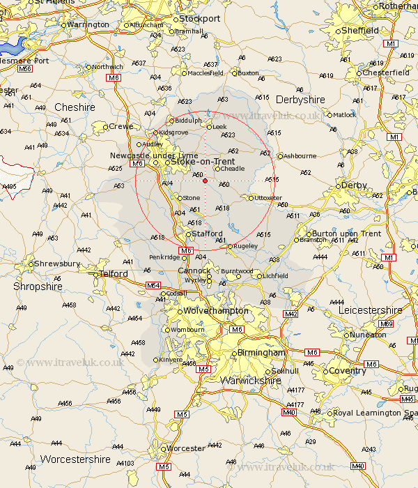
Staffordshire Map Showing Location of Cresswell
Population: 359
District: Stafford
Easting: 397760 Northing: 339215
Latitude: 52.95 Longitude: -2.03
 = Cresswell
District: Stafford
Easting: 397760 Northing: 339215
Latitude: 52.95 Longitude: -2.03
= Cresswell
This Cresswell map below is supplied by Google. Use the tools in the top left corner to zoom into street level or zoom out for a road map, you may also need to zoom in to see Cresswell on the map. Click and drag the map to move around. If the map fails to load try and refresh your browser or zoom in or out (+ or -).
Update - it seems Google no longer allow people to use their maps for free! This Cresswell map sometimes loads and sometimes gives a error. I am working on a solution.
Closest 30 Towns or Cities to Cresswell (Population over 500)
Draycott in the Moors 1.86km Draycott 1.86km Fulford 2.23km Caverswall 4.32km Cheadle 4.99km Hilderstone 4.99km Leigh 5.8km Church Leigh 5.8km Checkley 5.89km Kingsley 8.14km Stone 8.71km Barlaston 8.93km Oakamoor 9.59km Alton 10.22km Ipstones 10.28km Cheddleton 11.12km Stoke upon Trent 11.48km Stoke 11.48km Stoke-upon-Trent 11.48km Stoke on Trent 11.48km Stoke-on-Trent 11.48km Denstone 12.42km Denston 12.42km Swynnerton 12.83km Swinnerton 12.83km Weston upon Trent 13.02km Weston 13.02km Rocester 13.4km Uttoxeter 13.49km Hopton 13.73km