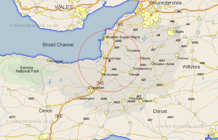
Somerset Map Showing Location of Cote
District: Sedgemoor
Easting: 334797 Northing: 145003
Latitude: 51.2 Longitude: -2.93
 = Cote
Easting: 334797 Northing: 145003
Latitude: 51.2 Longitude: -2.93
= Cote
This Cote map below is supplied by Google. Use the tools in the top left corner to zoom into street level or zoom out for a road map, you may also need to zoom in to see Cote on the map. Click and drag the map to move around. If the map fails to load try and refresh your browser or zoom in or out (+ or -).
Update - it seems Google no longer allow people to use their maps for free! This Cote map sometimes loads and sometimes gives a error. I am working on a solution.
Closest 30 Towns or Cities to Cote (Population over 500)
Mark 2.97km Huntspill 3.48km Highbridge 3.95km Puriton 4.37km Pawlett 5km Cossington 5.68km Burnham-on-Sea 5.94km Burnham 5.94km Burnham on Sea 5.94km Brent Knoll 6.03km Wedmore 8.34km Weston Zoyland 9.26km Lympsham 9.33km Berrow 9.42km Weare 10.17km Shapwick 10.18km Bridgwater 10.36km Bridgewater 10.36km Otterhampton 10.62km Brean 10.93km Meare 11.09km Bleadon 11.18km Middlezoy 11.36km Ashcott 11.89km Durleigh 12.33km North Petherton 12.55km Priddy 12.87km Hutton 12.98km Axbridge 13.11km Othery 13.44km