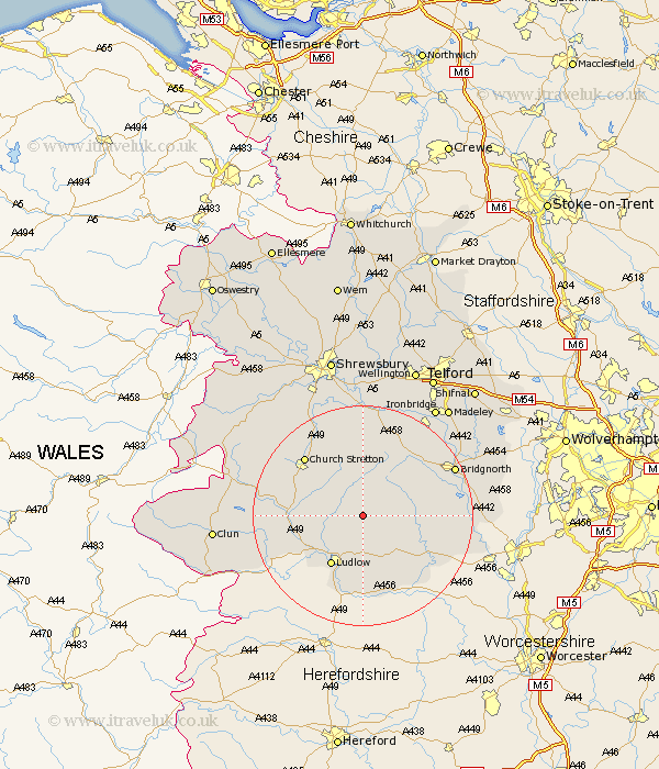
Shropshire Map Showing Location of Clee St. Margaret
District: South Shropshire
Easting: 355830 Northing: 283800
Latitude: 52.45 Longitude: -2.65
 = Clee St. Margaret
Easting: 355830 Northing: 283800
Latitude: 52.45 Longitude: -2.65
= Clee St. Margaret
This Clee St. Margaret map below is supplied by Google. Use the tools in the top left corner to zoom into street level or zoom out for a road map, you may also need to zoom in to see Clee St. Margaret on the map. Click and drag the map to move around. If the map fails to load try and refresh your browser or zoom in or out (+ or -).
Update - it seems Google no longer allow people to use their maps for free! This Clee St. Margaret map sometimes loads and sometimes gives a error. I am working on a solution.
Closest 30 Towns or Cities to Clee St. Margaret (Population over 500)
Diddlebury 4.88km Bitterley 5.56km Ditton Priors 7.92km Rushbury 8.68km Ludlow 10.85km Caynham 11.18km Craven Arms 12.56km Cleobury Mortimer 13.52km Wistanstow 13.68km Church Stretton 15.06km Kinlet 16.25km Much Wenlock 18km Highley 18.07km Bridgnorth 18.31km Alveley 20.33km Lydbury North 20.41km North Lydbury 20.41km Cressage 20.51km Barrow Bridge 20.79km Barrow 20.79km Broseley 21.7km Worfield 22.17km Bucknell 22.36km Berrington 22.49km Condover 23.24km Ironbridge 23.86km Baystonhill 25.03km Madeley 25.1km Claverley 25.44km Clun 26.25km