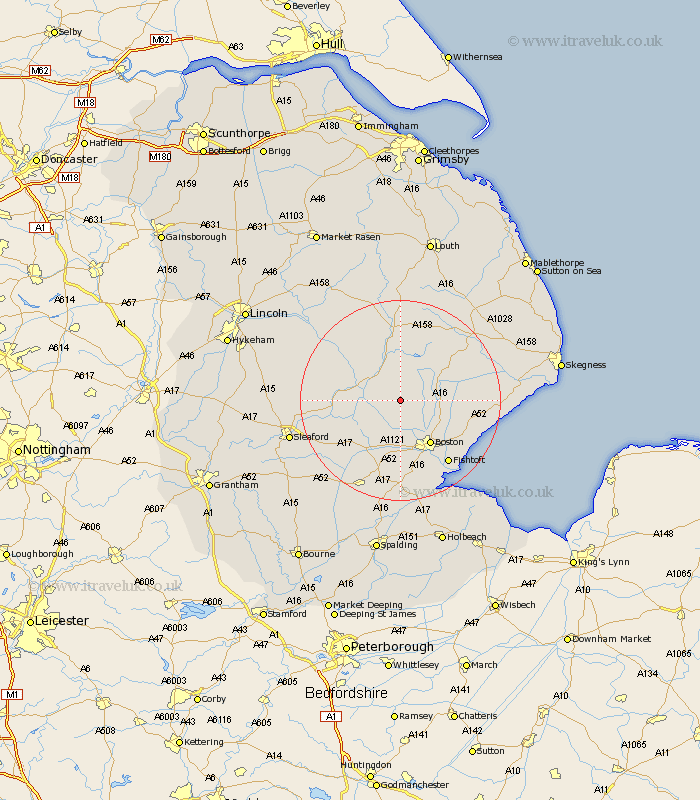
Lincolnshire Map Showing Location of Bunkers Hill
District: East Lindsey
Easting: 527294 Northing: 353882
Latitude: 53.07 Longitude: -0.1
 = Bunkers Hill
Easting: 527294 Northing: 353882
Latitude: 53.07 Longitude: -0.1
= Bunkers Hill
This Bunkers Hill map below is supplied by Google. Use the tools in the top left corner to zoom into street level or zoom out for a road map, you may also need to zoom in to see Bunkers Hill on the map. Click and drag the map to move around. If the map fails to load try and refresh your browser or zoom in or out (+ or -).
Update - it seems Google no longer allow people to use their maps for free! This Bunkers Hill map sometimes loads and sometimes gives a error. I am working on a solution.
Closest 30 Towns or Cities to Bunkers Hill (Population over 500)
Carrington 3.82km Frithville 5.8km Coningsby 7.12km Tattershall 7.64km Stickney 8.01km Sibsey 8.64km Brothertoft 9.27km Boston 10.82km Woodhall Spa 12.1km Billinghay 12.39km Mareham on the Hill 13.16km Mareham 13.16km Mareham-on-the-Hill 13.16km Leverton 14.33km Old Leake 14.48km Leake 14.48km Butterwick 14.5km Banovallum 14.86km Horncastle 14.86km Wrangle 14.95km Frieston 14.98km Freiston 14.98km Swineshead 15.21km Benington 15.37km Bennington 15.37km Fishtoft 15.75km Wyberton 15.85km Martin 16.54km Heckington 16.55km Kirton 17.01km