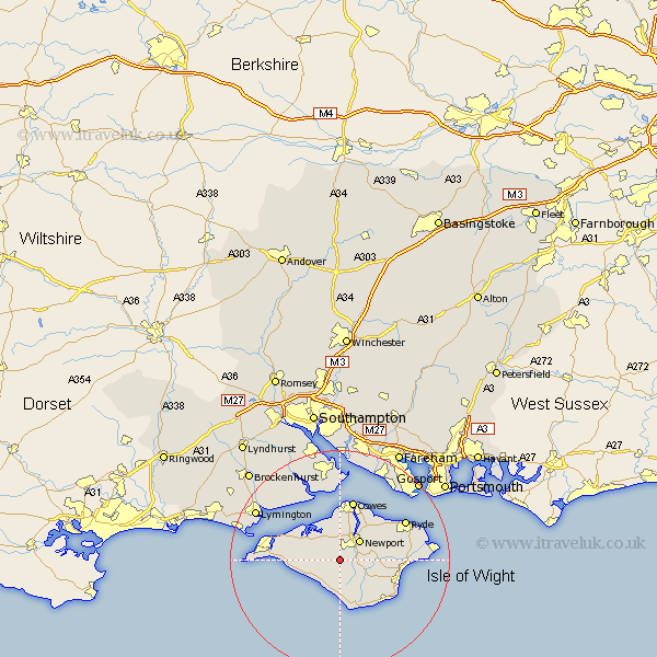
Hampshire Map Showing Location of Bowcombe
Easting: 447109 Northing: 85502
Latitude: 50.67 Longitude: -1.33
 = Bowcombe
Latitude: 50.67 Longitude: -1.33
= Bowcombe
This Bowcombe map below is supplied by Google. Use the tools in the top left corner to zoom into street level or zoom out for a road map, you may also need to zoom in to see Bowcombe on the map. Click and drag the map to move around. If the map fails to load try and refresh your browser or zoom in or out (+ or -).
Update - it seems Google no longer allow people to use their maps for free! This Bowcombe map sometimes loads and sometimes gives a error. I am working on a solution.
Closest 30 Towns or Cities to Bowcombe (Population over 500)
Shorwell 3.9km Rookley 3.98km Calbourne 4.7km Newport 5.11km Brightstone 5.12km Brighstone 5.12km Arreton 5.87km Shalfleet 5.98km Northwood 7.5km Godshill 8.09km Wootton 8.97km Gurnard 9.34km Chale 9.35km Newchurch 9.4km East Cowes 9.55km Niton 9.92km Wroxall 11.08km Cowes 11.36km Shanklin 11.95km Yarmouth 12.31km Jentnor 12.92km Ventnor 12.92km Freshwater 12.92km Brading 13.05km Sandown 13.06km Ryde 13.88km Totland 14.1km St. Helens 15.71km St Helens 15.71km Saint Helens 15.71km