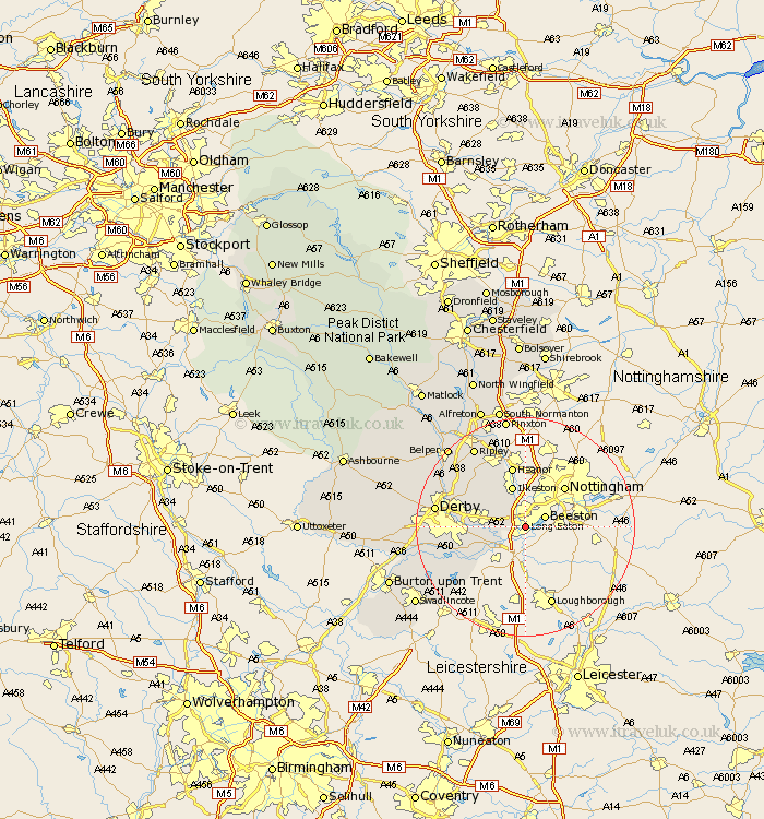
Derbyshire Map Showing Location of Long Eaton
Population: 44360
Area Size (ha): 990
District: Erewash
Easting: 449322 Northing: 333904
Latitude: 52.9 Longitude: -1.27
 = Long Eaton
Area Size (ha): 990
District: Erewash
Easting: 449322 Northing: 333904
Latitude: 52.9 Longitude: -1.27
= Long Eaton
This Long Eaton map below is supplied by Google. Use the tools in the top left corner to zoom into street level or zoom out for a road map, you may also need to zoom in to see Long Eaton on the map. Click and drag the map to move around. If the map fails to load try and refresh your browser or zoom in or out (+ or -).
Update - it seems Google no longer allow people to use their maps for free! This Long Eaton map sometimes loads and sometimes gives a error. I am working on a solution.
Closest 30 Towns or Cities to Long Eaton (Population over 500)
Sandiacre 2.17km Risley 3.83km Sawley 4.33km Dale Abbey 6.7km Ilkeston 7.75km Borrowash 7.82km West Hallam 7.88km Shardlow 7.89km Heanor 11.34km Shipley Gate Station 11.61km Weston-on-Trent 11.62km Weston on Trent 11.62km Weston upon Trent 11.62km Smalley 12.12km Breadsall 12.84km Little Eaton 13.49km Melbourne 14.53km Denby 15.75km Kilbourne 15.76km Kilbourn 15.76km Kilburn 15.76km Derby 16.08km Codnor 16.27km Duffield 16.31km Quarndon 16.6km Ripley 17.3km Holbrook 17.41km Ticknall 18.31km Findern 18.74km Heage 19.25km