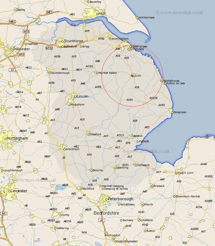
Lincolnshire Map Showing Location of Louth
Population: 14093
Area Size (ha): 441
District: East Lindsey
Easting: 531951 Northing: 387399
Latitude: 53.37 Longitude: -0.02
 = Louth
Area Size (ha): 441
District: East Lindsey
Easting: 531951 Northing: 387399
Latitude: 53.37 Longitude: -0.02
= Louth
This Louth map below is supplied by Google. Use the tools in the top left corner to zoom into street level or zoom out for a road map, you may also need to zoom in to see Louth on the map. Click and drag the map to move around. If the map fails to load try and refresh your browser or zoom in or out (+ or -).
Update - it seems Google no longer allow people to use their maps for free! This Louth map sometimes loads and sometimes gives a error. I am working on a solution.
Closest 30 Towns or Cities to Louth (Population over 500)
Legbourne 5.78km Grimoldby 6.63km Manby 7.74km Fulstow 9.26km North Thoresby 11.34km North Coates 11.6km Grainthorpe 12.94km Tetney 12.97km binbrook 13.3km North Somercotes 13.3km Saltfleetby 13.77km Saltfleetby Saint Clement 13.77km Saltfleetby St. Clement 13.77km Saltfleetby St Clement 13.77km Saltfleet 14.38km Holton le Clay 17.01km Waltham 17.57km Mablethorpe 18.09km Humberstone 18.56km Humberston 18.56km Alford 18.57km Grimsby 18.66km Great Grimsby 18.66km Horncastle 19.69km Banovallum 19.69km Cleethorpes 20.41km Mareham on the Hill 20.66km Mareham 20.66km Mareham-on-the-Hill 20.66km Sutton-on-Sea 20.68km