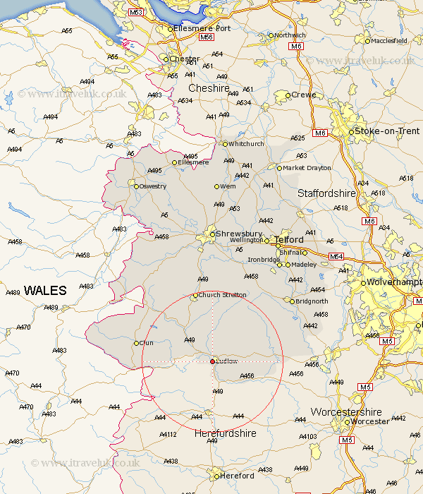
Shropshire Map Showing Location of Ludlow
Population: 8868
Area Size (ha): 222
District: South Shropshire
Easting: 350074 Northing: 274589
Latitude: 52.37 Longitude: -2.73
 = Ludlow
Area Size (ha): 222
District: South Shropshire
Easting: 350074 Northing: 274589
Latitude: 52.37 Longitude: -2.73
= Ludlow
This Ludlow map below is supplied by Google. Use the tools in the top left corner to zoom into street level or zoom out for a road map, you may also need to zoom in to see Ludlow on the map. Click and drag the map to move around. If the map fails to load try and refresh your browser or zoom in or out (+ or -).
Update - it seems Google no longer allow people to use their maps for free! This Ludlow map sometimes loads and sometimes gives a error. I am working on a solution.
Closest 30 Towns or Cities to Ludlow (Population over 500)
Caynham 4.89km Bitterley 6.76km Craven Arms 10.04km Diddlebury 11.18km Wistanstow 13.65km Bucknell 14.71km Rushbury 16.72km Cleobury Mortimer 17.07km North Lydbury 18.43km Lydbury North 18.43km Ditton Priors 18.64km Church Stretton 20.88km Clun 21.1km Kinlet 22.2km Highley 25.48km Alveley 27.6km Bridgnorth 28.35km Much Wenlock 28.76km Shelve 29.44km Cressage 30.68km Condover 31.52km Berrington 31.58km Barrow Bridge 31.61km Barrow 31.61km Worfield 32.13km Broseley 32.55km Minsterley 32.59km Pontesbury 33.1km Baystonhill 33.38km Chirbury 33.79km