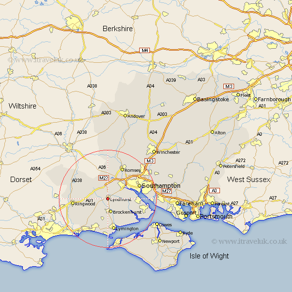
Hampshire Map Showing Location of Lyndhurst
Population: 2385
Area Size (ha): 88
District: New Forest
Easting: 429318 Northing: 107610
Latitude: 50.87 Longitude: -1.58
 = Lyndhurst
Area Size (ha): 88
District: New Forest
Easting: 429318 Northing: 107610
Latitude: 50.87 Longitude: -1.58
= Lyndhurst
This Lyndhurst map below is supplied by Google. Use the tools in the top left corner to zoom into street level or zoom out for a road map, you may also need to zoom in to see Lyndhurst on the map. Click and drag the map to move around. If the map fails to load try and refresh your browser or zoom in or out (+ or -).
Update - it seems Google no longer allow people to use their maps for free! This Lyndhurst map sometimes loads and sometimes gives a error. I am working on a solution.
Closest 30 Towns or Cities to Lyndhurst (Population over 500)
Minstead 2.19km Cadnam 5.56km Brockenhurst 5.68km Bramshaw 7.77km Eling 7.93km Totton 8.95km Sway 9.35km Burley 9.9km Dibden 10.53km Marchwood 10.69km Beaulieu 10.89km Bewley 10.89km West Wellow 11.12km Boldre 11.66km Hythe 12.87km Sherfield English 12.96km Hordle 13.03km Lymington 13.19km Hale 14.01km Bransgore 14.04km Ibsley 14.15km Southampton 14.16km Ringwood 14.16km Romsey 14.22km Itchen 14.51km Chilworth 14.91km New Milton 15.56km Milton 15.56km Milford-on-Sea 15.77km Milford 15.77km