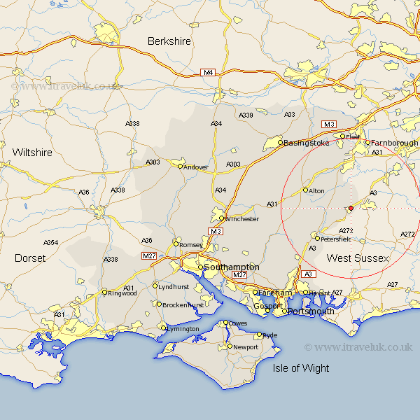
Hampshire Map Showing Location of Bramshot
Population: 7904
District: East Hampshire
Easting: 484043 Northing: 132297
Latitude: 51.08 Longitude: -0.8
 = Bramshot
District: East Hampshire
Easting: 484043 Northing: 132297
Latitude: 51.08 Longitude: -0.8
= Bramshot
This Bramshot map below is supplied by Google. Use the tools in the top left corner to zoom into street level or zoom out for a road map, you may also need to zoom in to see Bramshot on the map. Click and drag the map to move around. If the map fails to load try and refresh your browser or zoom in or out (+ or -).
Update - it seems Google no longer allow people to use their maps for free! This Bramshot map sometimes loads and sometimes gives a error. I am working on a solution.
Closest 30 Towns or Cities to Bramshot (Population over 500)
Liphook 1.85km Headley 3.89km Bordon Camp 5.1km Bordon 5.1km Kingsley 5.96km Greatham 7.91km Liss 8.93km Selborne 9.31km Binsted 9.43km Steep 11.9km Bentley 12.05km Froyle 12.34km Upper Farringdon 12.94km Faringdon 12.94km Farringdon 12.94km Petersfield 13.14km Alton 13.95km Crondall 15.24km Froxfield 15.82km Buriton 16.68km Long Sutton 17.51km Four Marks 17.85km Aldershot 18.68km Medstead 18.99km East Meon 19.74km Ropley 19.88km Upton Grey 20.36km Odiham 20.74km Farnborough 20.92km West Meon 21.14km