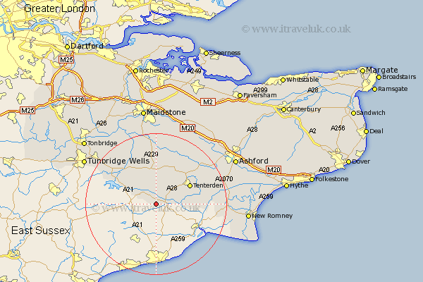
Kent Map Showing Location of Sandhurst
Population: 1328
District: Tunbridge Wells
Easting: 580007 Northing: 127342
Latitude: 51.02 Longitude: 0.57
 = Sandhurst
District: Tunbridge Wells
Easting: 580007 Northing: 127342
Latitude: 51.02 Longitude: 0.57
= Sandhurst
This Sandhurst map below is supplied by Google. Use the tools in the top left corner to zoom into street level or zoom out for a road map, you may also need to zoom in to see Sandhurst on the map. Click and drag the map to move around. If the map fails to load try and refresh your browser or zoom in or out (+ or -).
Update - it seems Google no longer allow people to use their maps for free! This Sandhurst map sometimes loads and sometimes gives a error. I am working on a solution.
Closest 30 Towns or Cities to Sandhurst (Population over 500)
Benenden 3.88km Beneden 3.88km Hawkhurst 5.01km Rolvenden 5.01km Cranbrook 7.76km Wittersham 9.51km Biddenden 10.37km Tenterden 10.81km Goudhurst 12.34km High Halden 12.84km Frittenden 13.02km Horsmonden 14.51km Lamberhurst 14.8km Staplehurst 15km Woodchurch 15.05km Headcorn 15.23km Smarden 15.31km Marden 17.32km Brenchley 17.43km Bethersden 17.86km Shadoxhurst 19.78km Ham Street 20.16km Sutton Valence 20.41km Orlestone 20.57km Paddock Wood 21.03km Ulcombe 21.2km Hunton 21.2km Pembury 21.75km Kingsnorth 21.86km Egerton 21.88km