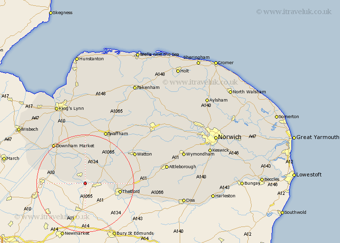
Norfolk Map Showing Location of Hockwold
Population: 1233
District: King's Lynn and West Norfolk
Easting: 573266 Northing: 286659
Latitude: 52.45 Longitude: 0.55
 = Hockwold
District: King's Lynn and West Norfolk
Easting: 573266 Northing: 286659
Latitude: 52.45 Longitude: 0.55
= Hockwold
This Hockwold map below is supplied by Google. Use the tools in the top left corner to zoom into street level or zoom out for a road map, you may also need to zoom in to see Hockwold on the map. Click and drag the map to move around. If the map fails to load try and refresh your browser or zoom in or out (+ or -).
Update - it seems Google no longer allow people to use their maps for free! This Hockwold map sometimes loads and sometimes gives a error. I am working on a solution.
Closest 30 Towns or Cities to Hockwold (Population over 500)
Feltwell 3.87km Weeting 4.52km Methwold 7.42km Mundford 8.76km Northwold 11.62km Stoke Ferry 13.17km Southery 13.5km Thetford 14.06km Hilgay 15.06km Wereham 15.49km Denver 19.33km Downham Market 20.79km Welney 21.63km Marham 22.24km Shouldham 22.69km Watton 23.15km Hockham 23.25km Swaffham 23.6km Ashill 23.75km Harling 24.02km Griston 24.15km Runcton Holme 24.44km Runcton 24.44km Narborough 26.04km East Harling 26.05km Rockland Saint Peter 26.5km Rockland 26.5km Rockland St. Peter 26.5km Rockland St Peter 26.5km Watlington 26.6km