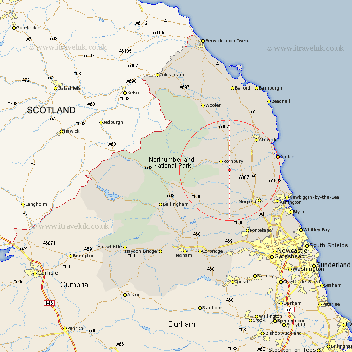
Northumberland Map Showing Location of Brinkburn Station
Population: 200
District: Alnwick
Easting: 409526 Northing: 598811
Latitude: 55.28 Longitude: -1.85
 = Brinkburn Station
District: Alnwick
Easting: 409526 Northing: 598811
Latitude: 55.28 Longitude: -1.85
= Brinkburn Station
This Brinkburn Station map below is supplied by Google. Use the tools in the top left corner to zoom into street level or zoom out for a road map, you may also need to zoom in to see Brinkburn Station on the map. Click and drag the map to move around. If the map fails to load try and refresh your browser or zoom in or out (+ or -).
Update - it seems Google no longer allow people to use their maps for free! This Brinkburn Station map sometimes loads and sometimes gives a error. I am working on a solution.
Closest 30 Towns or Cities to Brinkburn Station (Population over 500)
Longframlington 4.22km Rothbury 4.88km Swarland 7.62km Longhorsley 7.67km Felton 9.5km Thirston 10.55km East Thirston 10.55km Shilbottle 14.04km Hebron 15.34km Alnwick 16.07km Almwick 16.07km Warkworth 16.52km Morpeth 16.73km East Chevington 16.89km Amble 17.77km Lisburg 18.48km Lesbury 18.48km Pegswood 18.89km Ellington 19.43km Hepscott 19.51km Alnmouth 20.45km Lynemouth 21km Ashington 21.35km Otterburn 21.39km Newbiggin-by-the-Sea 23.3km Newbiggin by the Sea 23.3km Stannington 23.47km Bedlington 23.72km Embleton 26.68km Ponteland 26.71km