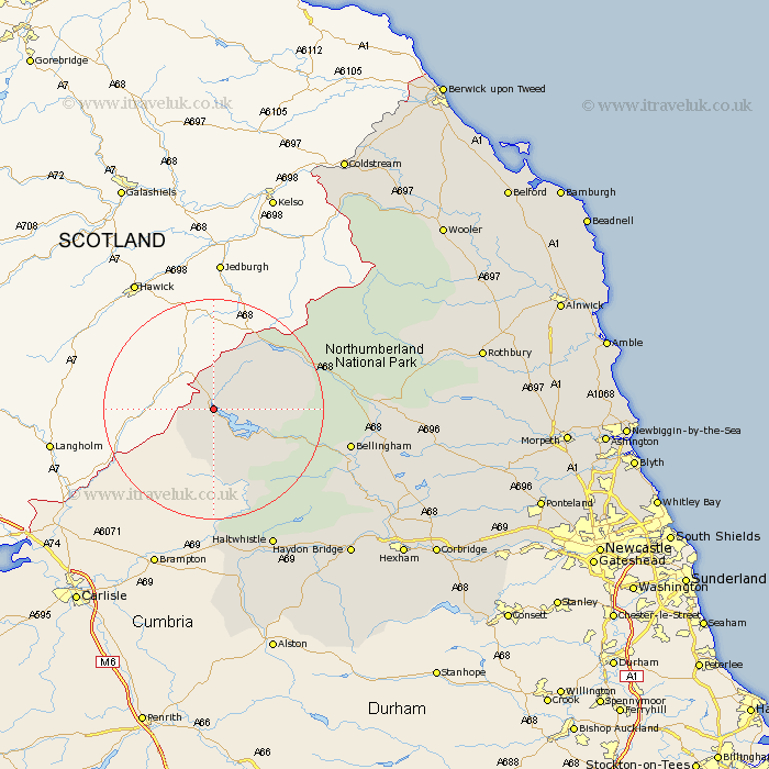
Northumberland Map Showing Location of Kielder
Population: 207
District: Tynedale
Easting: 362890 Northing: 591545
Latitude: 55.22 Longitude: -2.58
 = Kielder
District: Tynedale
Easting: 362890 Northing: 591545
Latitude: 55.22 Longitude: -2.58
= Kielder
This Kielder map below is supplied by Google. Use the tools in the top left corner to zoom into street level or zoom out for a road map, you may also need to zoom in to see Kielder on the map. Click and drag the map to move around. If the map fails to load try and refresh your browser or zoom in or out (+ or -).
Update - it seems Google no longer allow people to use their maps for free! This Kielder map sometimes loads and sometimes gives a error. I am working on a solution.
Closest 30 Towns or Cities to Kielder (Population over 500)
Bellingham 23.43km Otterburn 26.43km Haltwhistle 27.65km Wark 28.66km Newbrough 35.04km Humshaugh 35.13km Haydon Bridge 35.62km Challerton 36.88km Chollerton 36.88km Warden 38.64km Acomb 40.24km Hexham 41.46km Sandhoe 42.72km Rothbury 44.7km Corbridge 45.53km Slaley 49.67km Stamfordham 49.92km Ridingmill 50.34km Riding 50.34km Wooler 50.97km Longframlington 51.24km Longhorsley 51.83km Stocksfield 52.86km Ovingham 53.41km Wylam 54.32km Swarland 54.65km Prudhoe 55.3km Ponteland 56.12km Felton 56.47km Hebron 57.23km