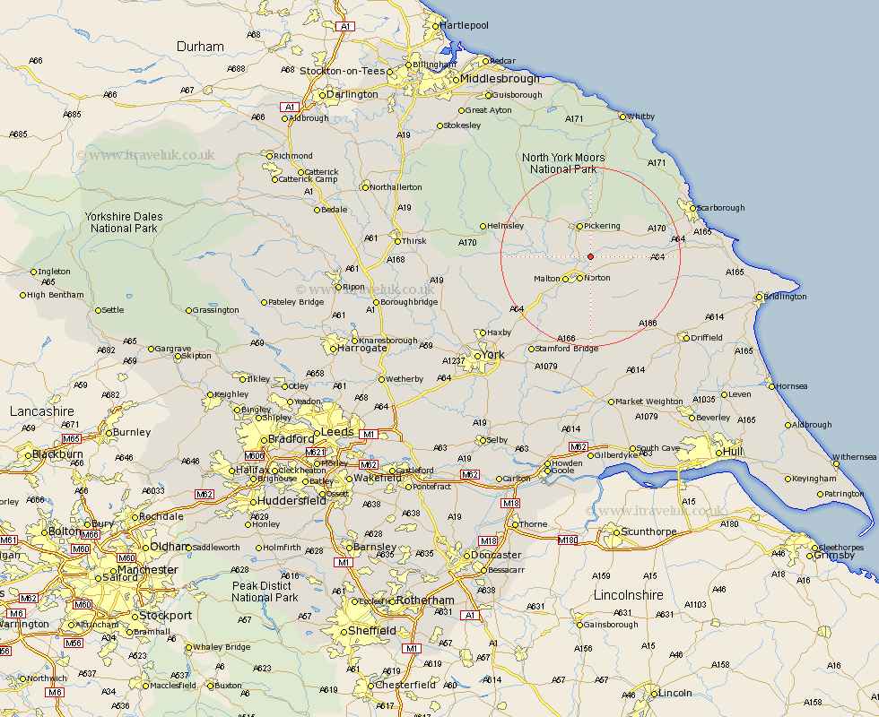
Yorkshire Map Showing Location of Marishes Road Station
Population: 123
District: Ryedale
Easting: 482654 Northing: 477151
Latitude: 54.18 Longitude: -0.73
 = Marishes Road Station
District: Ryedale
Easting: 482654 Northing: 477151
Latitude: 54.18 Longitude: -0.73
= Marishes Road Station
This Marishes Road Station map below is supplied by Google. Use the tools in the top left corner to zoom into street level or zoom out for a road map, you may also need to zoom in to see Marishes Road Station on the map. Click and drag the map to move around. If the map fails to load try and refresh your browser or zoom in or out (+ or -).
Update - it seems Google no longer allow people to use their maps for free! This Marishes Road Station map sometimes loads and sometimes gives a error. I am working on a solution.
Closest 30 Towns or Cities to Marishes Road Station (Population over 500)
Rillington 4.29km Norton 5.62km Thornton-le-Dale 5.66km Thornton Dale 5.66km Malton 7.47km Pickering 7.73km Yedingham 7.81km Snainton 10.44km Brompton 12.49km Slingsby 12.5km Sherburn 14.22km Kirkby Moorside 15.97km Kirby Moorside 15.97km Terrington 16.9km Nawton 17.18km Willerby 18.44km Seamer 20.29km Sheriff Hutton 20.63km Great Driffield 21.63km Eastfield 22.38km Scalby 22.44km Helmsley 22.91km Wetwang 23.1km Scarborough 23.74km Cayton 24.48km Burniston 24.49km Strensall 24.54km Fangfoss 24.95km Ampleforth 25.01km Stamford Bridge 25.25km