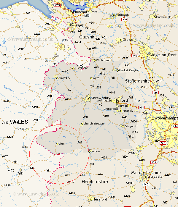
Shropshire Map Showing Location of Stow
Population: 122
District: South Shropshire
Easting: 330758 Northing: 272965
Latitude: 52.35 Longitude: -3.02
 = Stow
District: South Shropshire
Easting: 330758 Northing: 272965
Latitude: 52.35 Longitude: -3.02
= Stow
This Stow map below is supplied by Google. Use the tools in the top left corner to zoom into street level or zoom out for a road map, you may also need to zoom in to see Stow on the map. Click and drag the map to move around. If the map fails to load try and refresh your browser or zoom in or out (+ or -).
Update - it seems Google no longer allow people to use their maps for free! This Stow map sometimes loads and sometimes gives a error. I am working on a solution.
Closest 30 Towns or Cities to Stow (Population over 500)
Bucknell 4.89km Clun 7.5km North Lydbury 13.74km Lydbury North 13.74km Craven Arms 15.51km Wistanstow 17.21km Ludlow 19.33km Caynham 23.77km Diddlebury 24.14km Bitterley 25.5km Shelve 26.04km Chirburg 26.33km Chirbury 26.33km Church Stretton 26.65km Rushbury 27.52km Minsterley 32km Pontesbury 34.56km Ditton Priors 34.77km Cleobury Mortimer 36.4km Westbury 37.34km Condover 37.93km Great Hanwood 39.45km Hanwood 39.45km Baystonhill 39.57km Berrington 39.65km Alberbury 41.02km Kinlet 41.39km Cressage 41.54km Much Wenlock 42.09km Ford 42.3km