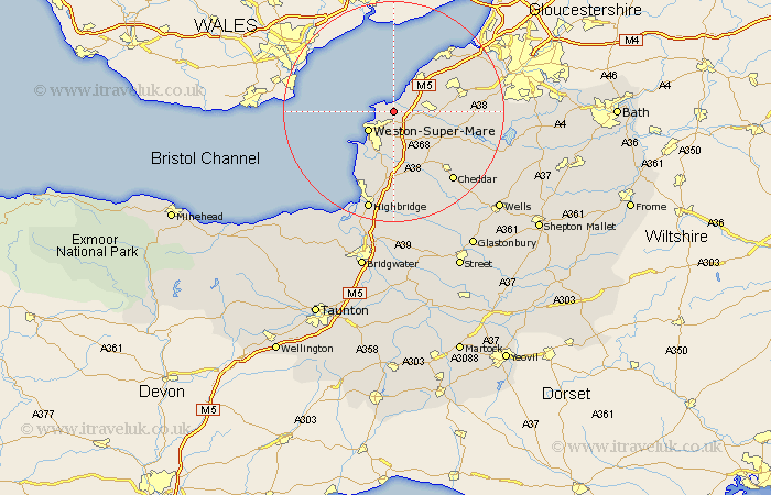
Somerset Map Showing Location of Wick St Lawrence
Population: 1296
Easting: 336215 Northing: 165370
Latitude: 51.38 Longitude: -2.92
 = Wick St Lawrence
Easting: 336215 Northing: 165370
Latitude: 51.38 Longitude: -2.92
= Wick St Lawrence
This Wick St Lawrence map below is supplied by Google. Use the tools in the top left corner to zoom into street level or zoom out for a road map, you may also need to zoom in to see Wick St Lawrence on the map. Click and drag the map to move around. If the map fails to load try and refresh your browser or zoom in or out (+ or -).
Update - it seems Google no longer allow people to use their maps for free! This Wick St Lawrence map sometimes loads and sometimes gives a error. I am working on a solution.
Closest 30 Towns or Cities to Wick St Lawrence (Population over 500)
Weston-Super-Mare 5.93km Locking 6.02km Yatton 6.94km Clevedon 7.23km Hutton 7.5km Sandford 8.02km Banwell 8.18km Congresbury 8.31km Bleadon 9.55km Churchill 9.83km Wrington 10.57km Lympsham 11.36km Nailsea 11.8km Weston 12.31km Weston in Gordano 12.31km Weston Down 12.31km Shipham 12.31km Brean 13.11km Axbridge 13.76km Portishead 13.94km Weare 14.2km Berrow 14.71km Wraxall 14.72km Blagdon 14.96km Brent Knoll 15.22km Flax Bourton 15.48km Bourton 15.48km Cheddar 16.64km Portbury 16.68km Burnham-on-Sea 17.66km