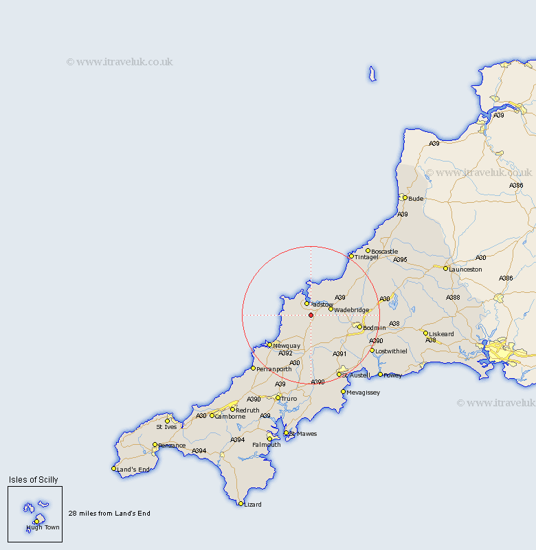
Cornwall Map Showing Location of Saint Issey
Population: 881
District: North Cornwall
Easting: 193183 Northing: 70818
Latitude: 50.5 Longitude: -4.92
 = Saint Issey
District: North Cornwall
Easting: 193183 Northing: 70818
Latitude: 50.5 Longitude: -4.92
= Saint Issey
This Saint Issey map below is supplied by Google. Use the tools in the top left corner to zoom into street level or zoom out for a road map, you may also need to zoom in to see Saint Issey on the map. Click and drag the map to move around. If the map fails to load try and refresh your browser or zoom in or out (+ or -).
Update - it seems Google no longer allow people to use their maps for free! This Saint Issey map sometimes loads and sometimes gives a error. I am working on a solution.
Closest 30 Towns or Cities to Saint Issey (Population over 500)
Padstow 3.89km St Merryn 3.99km St. Merryn 3.99km Saint Merryn 3.99km Wadebridge 6.18km St Columb Major 7.51km St. Columb 7.51km St Columb 7.51km St. Columb Major 7.51km Saint Columb Major 7.51km Saint Columb 7.51km Lanivet 11.98km Roche 12.59km St. Denis 13.19km St Dennis 13.19km Saint Dennis 13.19km St. Dennis 13.19km Saint Denis 13.19km St Denis 13.19km Bodmin 14.63km Stenalees 14.99km Newquay 15km Bugle 15.38km Blisland 16.6km Crantock 18km St Blazey 18km St. Blazey 18km Saint Blazey 18km St Stephen 18.57km Saint Stephen 18.57km