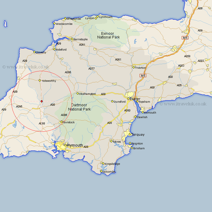
Devon Map Showing Location of Saint Giles
Population: 617
District: Torridge
Easting: 235183 Northing: 89732
Latitude: 50.68 Longitude: -4.33
 = Saint Giles
District: Torridge
Easting: 235183 Northing: 89732
Latitude: 50.68 Longitude: -4.33
= Saint Giles
This Saint Giles map below is supplied by Google. Use the tools in the top left corner to zoom into street level or zoom out for a road map, you may also need to zoom in to see Saint Giles on the map. Click and drag the map to move around. If the map fails to load try and refresh your browser or zoom in or out (+ or -).
Update - it seems Google no longer allow people to use their maps for free! This Saint Giles map sometimes loads and sometimes gives a error. I am working on a solution.
Closest 30 Towns or Cities to Saint Giles (Population over 500)
Broadwoodwidger 5.87km Ashwater 6.58km Lifton 6.58km Milton Abbot 10.97km Halwill 11.64km Pyworthy 13.8km Bridgerule 14.76km Holsworthy 14.88km Bridestowe 16.44km Lamerton 16.73km Northlew 17.85km Black Torrington 18.2km Gunnislake 18.6km Tavistock 19.67km Shebbear 20.27km Whitechurch 21.85km Whitchurch 21.85km Hatherleigh 23.92km Okehampton 24.12km Bradworthy 24.35km Buckland Monachorum 24.79km Horrabridge 26.21km Walkhampton 26.41km Langtree 27.59km Yelverton 28.39km Sampford Courtenay 29.18km Sampford Courtnay 29.18km Sampford Courtney 29.18km Meavy 29.91km Dolton 30.65km