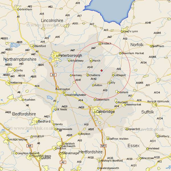
Cambridgeshire Map Showing Location of Manea
Population: 1175
Area Size (ha): 55
District: Fenland
Easting: 548243 Northing: 289549
Latitude: 52.48 Longitude: 0.18
 = Manea
Area Size (ha): 55
District: Fenland
Easting: 548243 Northing: 289549
Latitude: 52.48 Longitude: 0.18
= Manea
This Manea map below is supplied by Google. Use the tools in the top left corner to zoom into street level or zoom out for a road map, you may also need to zoom in to see Manea on the map. Click and drag the map to move around. If the map fails to load try and refresh your browser or zoom in or out (+ or -).
Update - it seems Google no longer allow people to use their maps for free! This Manea map sometimes loads and sometimes gives a error. I am working on a solution.
Closest 30 Towns or Cities to Manea (Population over 500)
Downham 7.17km Doddington 7.9km Wimblington 8.11km Littleport 8.73km Chatteris 9.76km March 10.04km Mepal 10.31km Ely 10.85km Witchford 11.18km Sutton 12.47km Stretham 13.16km Wilburton 14.87km Haddenham 15km Elm 16.68km Somersham 16.68km Colne 17.2km Bluntisham 18.64km Earith 18.64km Warboys 19.31km Willingham 20.15km Soham 20.15km Wisbech 20.42km Bury 20.58km Ramsey 20.66km Wistow 21.32km Over 21.71km Wicken 21.87km Whittlesey 22.67km Cottenham 22.69km Needingworth 22.97km