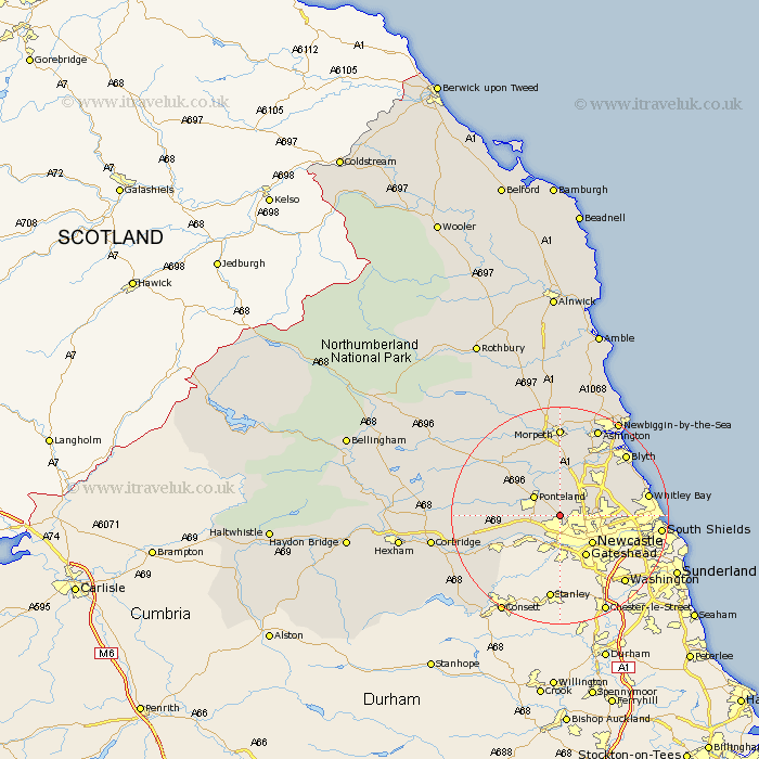
Northumberland Map Showing Location of Woolsington
Population: 7928
District: Newcastle upon Tyne
Easting: 420246 Northing: 569181
Latitude: 55.02 Longitude: -1.68
 = Woolsington
District: Newcastle upon Tyne
Easting: 420246 Northing: 569181
Latitude: 55.02 Longitude: -1.68
= Woolsington
This Woolsington map below is supplied by Google. Use the tools in the top left corner to zoom into street level or zoom out for a road map, you may also need to zoom in to see Woolsington on the map. Click and drag the map to move around. If the map fails to load try and refresh your browser or zoom in or out (+ or -).
Update - it seems Google no longer allow people to use their maps for free! This Woolsington map sometimes loads and sometimes gives a error. I am working on a solution.
Closest 30 Towns or Cities to Woolsington (Population over 500)
Dinnington 3.7km Gosforth 4.64km Ponteland 5.64km Newburn 6.41km Killingworth 7.66km Long Benton 7.67km Longbenton 7.67km Newcastle 7.7km Newcastle-on-Tyne 7.7km Newcastle on Tyne 7.7km Newcastle upon Tyne 7.7km Shiremoor 7.93km Wallsend on Tyne 8.37km Wallsend-on-Tyne 8.37km Wallsend 8.37km Cramlington 8.46km Dudley 8.91km Seghill 9.27km Stannington 9.32km Stamfordham 11.83km Seaton Delaval 11.99km Wylam 12km Ovingham 12.95km Prudhoe 12.96km North Shields 13.49km Bedlington 14.3km Seaton Sluice 14.85km Tynemouth 14.92km Hepscott 14.97km Whitley Bay 15.11km