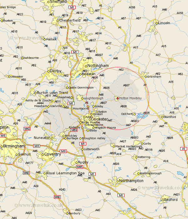
Leicestershire Map Showing Location of Melton Mowbray
Population: 24168
Area Size (ha): 624
District: Melton
Easting: 475334 Northing: 319410
Latitude: 52.77 Longitude: -0.88
 = Melton Mowbray
Area Size (ha): 624
District: Melton
Easting: 475334 Northing: 319410
Latitude: 52.77 Longitude: -0.88
= Melton Mowbray
This Melton Mowbray map below is supplied by Google. Use the tools in the top left corner to zoom into street level or zoom out for a road map, you may also need to zoom in to see Melton Mowbray on the map. Click and drag the map to move around. If the map fails to load try and refresh your browser or zoom in or out (+ or -).
Update - it seems Google no longer allow people to use their maps for free! This Melton Mowbray map sometimes loads and sometimes gives a error. I am working on a solution.
Closest 30 Towns or Cities to Melton Mowbray (Population over 500)
Ab Kettleby 2.9km Abkettley 2.9km Scalford 3.87km Waltham-on-the-Wolds 6.72km Waltham 6.72km Waltham on the Wolds 6.72km Frisby 6.73km Frisby-on-the-Wreak 6.73km Frisby on the Wreak 6.73km Hose 7.49km Eaton 8.66km Hoby 8.69km Gaddesby 9.3km Stathern 9.53km Wymondham 10.26km Twyford 11.34km Rearsby 11.53km Somerby 11.62km Queniboro 13.71km Queniborough 13.71km Wimeswould 14.69km Wymeswold 14.69km Syston 15.44km Sileby 15.61km Burton-on-the-Wolds 15.7km Burton on the Wolds 15.7km Burton 15.7km Redmile 15.84km Houghton 17.99km Houghton-on-the-Hill 17.99km