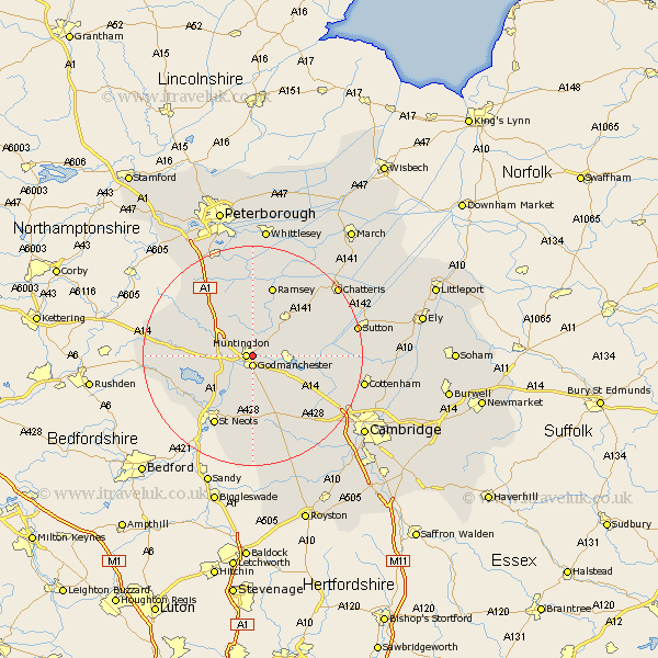
Cambridgeshire Map Showing Location of Huntingdon And Peterborough
District: Huntingdonshire
Easting: 524905 Northing: 272204
Latitude: 52.33 Longitude: -0.17
 = Huntingdon And Peterborough
Easting: 524905 Northing: 272204
Latitude: 52.33 Longitude: -0.17
= Huntingdon And Peterborough
This Huntingdon And Peterborough map below is supplied by Google. Use the tools in the top left corner to zoom into street level or zoom out for a road map, you may also need to zoom in to see Huntingdon And Peterborough on the map. Click and drag the map to move around. If the map fails to load try and refresh your browser or zoom in or out (+ or -).
Update - it seems Google no longer allow people to use their maps for free! This Huntingdon And Peterborough map sometimes loads and sometimes gives a error. I am working on a solution.
Closest 30 Towns or Cities to Huntingdon And Peterborough (Population over 500)
Huntingdon 1.13km Durolipons 1.85km Godmanchester 1.85km Wyton 3.4km Hemingford Grey 3.87km Hemingford 3.87km Hemingford Abbots 4.89km West Hemingford 4.89km Brampton 4.89km Brampton Grange 4.89km Offord Cluny 6km Offord 6km Fen Stanton 7.74km St. Ives 7.74km St Ives 7.74km Saint Ives 7.74km Alconbury 7.74km Buckden 7.94km Ellington 8.14km Hilton 8.68km Wistow 8.69km Graffham 8.75km Grafham 8.75km Great Paxton 9.87km Warboys 10.05km Bury 10.32km Needingworth 10.36km Little Paxton 10.86km Spaldwick 11.33km Elsworth 11.49km