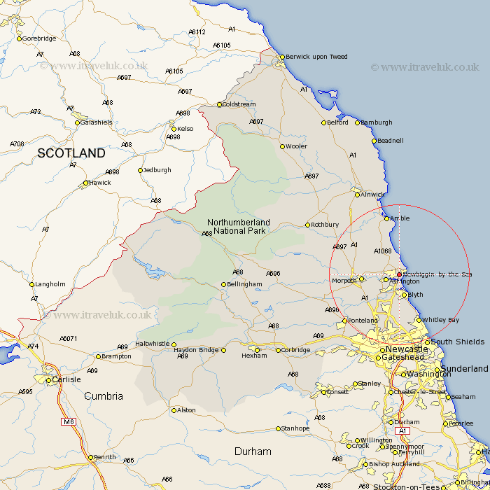
Northumberland Map Showing Location of Newbiggin By The Sea
Population: 7047
Area Size (ha): 108
District: Wansbeck
Easting: 429734 Northing: 587094
Latitude: 55.18 Longitude: -1.53
 = Newbiggin By The Sea
Area Size (ha): 108
District: Wansbeck
Easting: 429734 Northing: 587094
Latitude: 55.18 Longitude: -1.53
= Newbiggin By The Sea
This Newbiggin By The Sea map below is supplied by Google. Use the tools in the top left corner to zoom into street level or zoom out for a road map, you may also need to zoom in to see Newbiggin By The Sea on the map. Click and drag the map to move around. If the map fails to load try and refresh your browser or zoom in or out (+ or -).
Update - it seems Google no longer allow people to use their maps for free! This Newbiggin By The Sea map sometimes loads and sometimes gives a error. I am working on a solution.
Closest 30 Towns or Cities to Newbiggin By The Sea (Population over 500)
Ashington 3.7km Lynemouth 4.04km Ellington 4.88km Bedlington 5.99km Blythe 6.41km Blyth 6.41km Pegswood 6.47km Hepscott 8.02km Hebron 9.56km Morpeth 9.61km Seaton Sluice 10.52km Dudley 11.69km Stannington 12.07km East Chevington 12.22km Seaton Delaval 12.33km Cramlington 12.7km Seghill 14.19km Whitley 14.93km Whitley Bay 14.93km Thirston 15.17km East Thirston 15.17km Felton 15.85km Shiremoor 15.86km Longhorsley 16.08km Killingworth 16.14km Dinnington 17.07km Amble 17.65km Tynemouth 18.21km Swarland 18.65km North Shields 19.56km