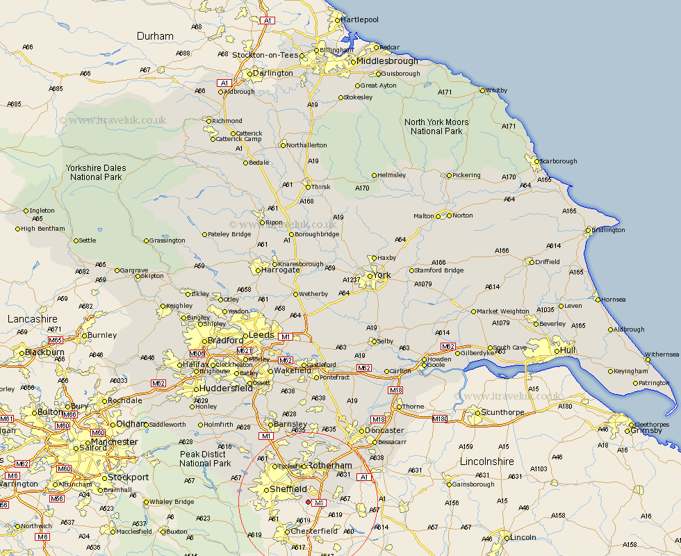
Yorkshire Map Showing Location of Beighton
Population: 9356
Area Size (ha): 189
District: Rotherham
Easting: 444390 Northing: 382058
Latitude: 53.33 Longitude: -1.33
 = Beighton
Area Size (ha): 189
District: Rotherham
Easting: 444390 Northing: 382058
Latitude: 53.33 Longitude: -1.33
= Beighton
This Beighton map below is supplied by Google. Use the tools in the top left corner to zoom into street level or zoom out for a road map, you may also need to zoom in to see Beighton on the map. Click and drag the map to move around. If the map fails to load try and refresh your browser or zoom in or out (+ or -).
Update - it seems Google no longer allow people to use their maps for free! This Beighton map sometimes loads and sometimes gives a error. I am working on a solution.
Closest 30 Towns or Cities to Beighton (Population over 500)
Aston 2.89km Wales 3.32km Harthill 4.8km Treeton 5.67km Todwick 5.84km Orgreave 5.98km Brampton en le Morthen 7.11km Brampton en le Morthern 7.11km Brampton 7.11km Whiston 7.42km Thorpe Salvin 7.96km Anston 9.45km Dinnington 9.6km Wickersley 9.85km Bramley 10.27km Rotherdam 11.17km Rotherham 11.17km Woodsetts 11.22km Sheffield 11.67km Maltby 12.82km Rawmarsh 12.98km Thrybergh 13.16km Braithwell 14.21km Ecclesfield 14.21km Wentworth 15.83km Swinton 16.72km Conisbrough 16.73km Conisborough 16.73km Tickhill 17.1km Mexborough 17.25km