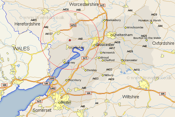
Gloucestershire Map Showing Location of Milcheldean
Population: 2209
Area Size (ha): 76
District: Forest of Dean
Easting: 366723 Northing: 218839
Latitude: 51.87 Longitude: -2.48
 = Milcheldean
Area Size (ha): 76
District: Forest of Dean
Easting: 366723 Northing: 218839
Latitude: 51.87 Longitude: -2.48
= Milcheldean
This Milcheldean map below is supplied by Google. Use the tools in the top left corner to zoom into street level or zoom out for a road map, you may also need to zoom in to see Milcheldean on the map. Click and drag the map to move around. If the map fails to load try and refresh your browser or zoom in or out (+ or -).
Update - it seems Google no longer allow people to use their maps for free! This Milcheldean map sometimes loads and sometimes gives a error. I am working on a solution.
Closest 30 Towns or Cities to Milcheldean (Population over 500)
Drybrook 2.18km Longhope 2.29km Cinderford 5.56km Huntley 5.72km Lydbrook 7.11km Newnham 8.17km Newham 8.17km Newent 9.36km Tibberton 9.87km Coleford 10.92km Awre 11.64km Staunton 12.73km Dymock 13.41km Frampton-on-Severn 13.71km Frampton 13.71km Frampton on Severn 13.71km Hartpury 13.76km Hardwicke 13.77km Bream 14.19km Corse 14.6km Newland 14.74km Quedgeley 14.82km Redmarley D'Abitot 15.87km Gloucester 16.45km Ashleworth 16.61km Lydney 17.03km Slimbridge 18.04km Stonehouse 18.91km Randwick 19.52km Innsworth 19.54km