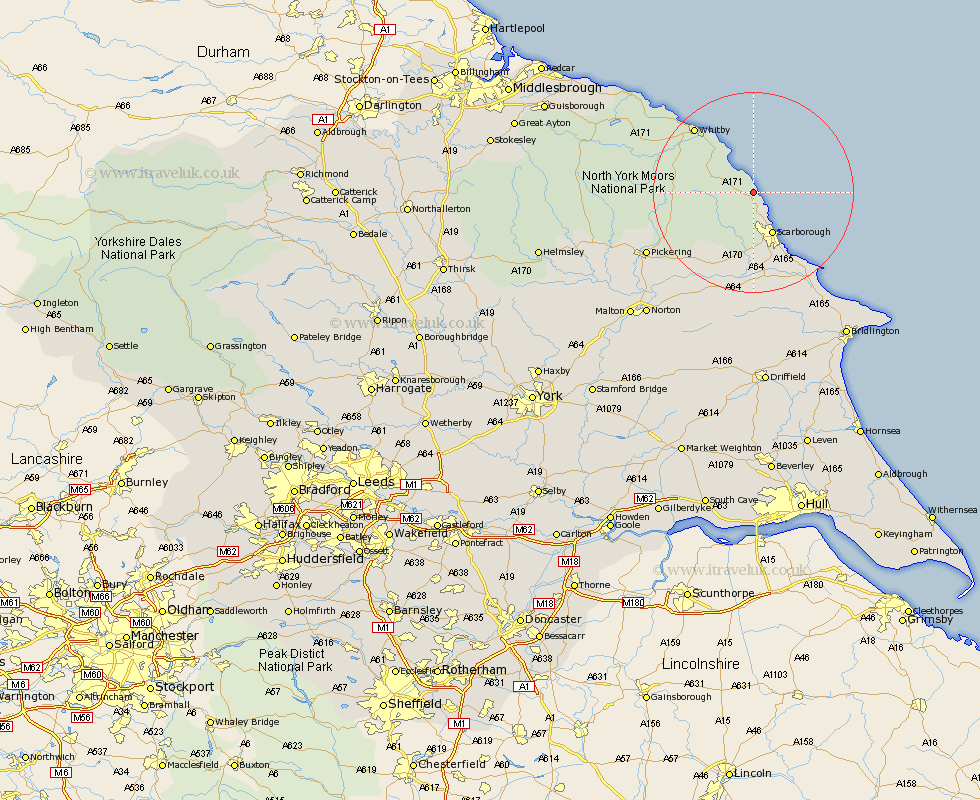
Yorkshire Map Showing Location of Staintondale
District: Scarborough
Easting: 499610 Northing: 497897
Latitude: 54.37 Longitude: -0.47
 = Staintondale
Easting: 499610 Northing: 497897
Latitude: 54.37 Longitude: -0.47
= Staintondale
This Staintondale map below is supplied by Google. Use the tools in the top left corner to zoom into street level or zoom out for a road map, you may also need to zoom in to see Staintondale on the map. Click and drag the map to move around. If the map fails to load try and refresh your browser or zoom in or out (+ or -).
Update - it seems Google no longer allow people to use their maps for free! This Staintondale map sometimes loads and sometimes gives a error. I am working on a solution.
Closest 30 Towns or Cities to Staintondale (Population over 500)
Cloughton 4.3km Burniston 5.96km Fylingdales 7.04km Scarborough 9.47km Scalby 9.52km Hawsker 11.3km Seamer 14.99km Eastfield 15.45km Sleights 15.92km Cayton 16.19km Whitby 17.04km Brompton 17.53km Snainton 18.32km Willerby 20.42km Filey 20.89km Yedingham 20.94km Thornton-le-Dale 21.98km Thornton Dale 21.98km Sherburn 22.47km Pickering 23.39km Hunmanby 24.28km Hinderwell 26.82km Rillington 28.47km Great Driffield 29.73km Norton 32.15km Kirby Moorside 32.25km Kirkby Moorside 32.25km Bempton 32.46km Loftus 33.78km Malton 34.22km