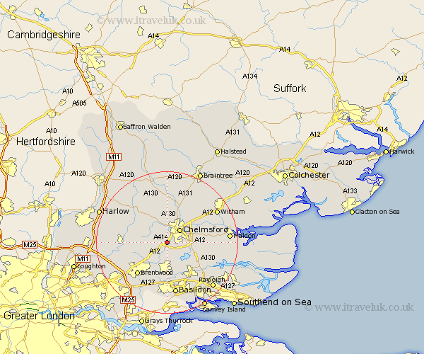
Essex Map Showing Location of Hylands
District: Chelmsford
Easting: 568136 Northing: 202993
Latitude: 51.7 Longitude: 0.43
 = Hylands
Easting: 568136 Northing: 202993
Latitude: 51.7 Longitude: 0.43
= Hylands
This Hylands map below is supplied by Google. Use the tools in the top left corner to zoom into street level or zoom out for a road map, you may also need to zoom in to see Hylands on the map. Click and drag the map to move around. If the map fails to load try and refresh your browser or zoom in or out (+ or -).
Update - it seems Google no longer allow people to use their maps for free! This Hylands map sometimes loads and sometimes gives a error. I am working on a solution.
Closest 30 Towns or Cities to Hylands (Population over 500)
Writtle 1.86km Margaretting 2.18km Galleywood 2.3km Great Baddow 4.59km Chelmsford 5.06km Ingatestone 5.06km Stock 5.56km Roxwell 6.54km West Hanningfield 7.21km Broomfield 7.76km East Hanningfield 8.85km Danbury 9.19km Great Waltham 9.33km Billericay 9.33km Ramsden Heath 9.34km Mountnessing 9.38km South Hanningfield 9.38km Rettendon 9.78km Little Baddow 9.9km Bicknacre 10.5km Bickacre 10.5km Boreham 10.93km Kelvedon Hatch 10.98km High Ongar 11.49km Little Waltham 11.64km Fyfield 12.06km Brentwood 12.27km High Easter 12.51km Wickford 12.52km Chipping Ongar 12.64km