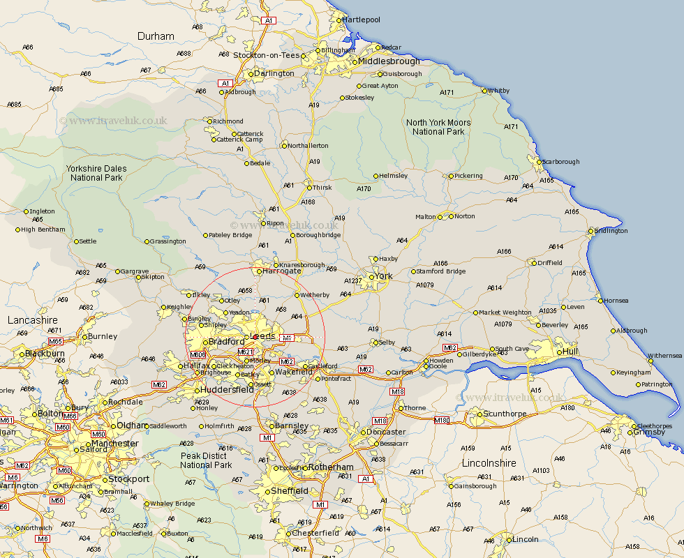
Yorkshire Map Showing Location of City
District: Leeds
Easting: 429635 Northing: 433861
Latitude: 53.8 Longitude: -1.55
 = City
Easting: 429635 Northing: 433861
Latitude: 53.8 Longitude: -1.55
= City
This City map below is supplied by Google. Use the tools in the top left corner to zoom into street level or zoom out for a road map, you may also need to zoom in to see City on the map. Click and drag the map to move around. If the map fails to load try and refresh your browser or zoom in or out (+ or -).
Update - it seems Google no longer allow people to use their maps for free! This City map sometimes loads and sometimes gives a error. I am working on a solution.
Closest 30 Towns or Cities to City (Population over 500)
Leeds 2.19km Horsforth 6.61km Rothwell 7.08km Morley 7.73km Pudsey 7.89km Lofthouse 8.11km Scholes 8.95km Swillington 9.51km Scarcroft 9.9km Bramhope 10.24km Thorner 10.37km Yeadon 10.66km Garforth 11.1km Arthington Junction Station 11.59km Arthington 11.59km Harewood 11.59km East Keswick 11.72km Pool-in-Wharfedale 11.95km Poole 11.95km Pool 11.95km Dewsbury 11.95km Drewsbury 11.95km Stanley 11.95km Wakefield 11.95km Bardsey 12.02km Kippax 12.6km Batley 12.72km Weeton 13.02km Guiseley 13.21km Bradford 13.27km