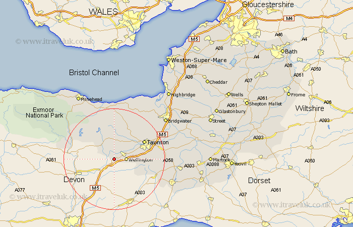
Somerset Map Showing Location of White Ball
District: Taunton Deane
Easting: 309894 Northing: 119431
Latitude: 50.97 Longitude: -3.28
 = White Ball
Easting: 309894 Northing: 119431
Latitude: 50.97 Longitude: -3.28
= White Ball
This White Ball map below is supplied by Google. Use the tools in the top left corner to zoom into street level or zoom out for a road map, you may also need to zoom in to see White Ball on the map. Click and drag the map to move around. If the map fails to load try and refresh your browser or zoom in or out (+ or -).
Update - it seems Google no longer allow people to use their maps for free! This White Ball map sometimes loads and sometimes gives a error. I am working on a solution.
Closest 30 Towns or Cities to White Ball (Population over 500)
Wellington 4.67km Milverton 6.03km West Buckland 7km Wiveliscombe 7.76km Oake 8.06km Pitminster 11.67km Norton Fitzwarren 11.91km Trull 12.24km Bishops Lydeard 13.14km Taunton 13.82km Kingston 16.11km Brushford 18.36km Stogumber 18.56km West Monkton 18.77km Williton 19.42km Creech Saint Michael 19.47km Creech St. Michael 19.47km Creech St Michael 19.47km Hatch Beauchamp 19.92km Dulverton 20.08km Spaxton 20.35km Combe St. Nicholas 21.2km Combe Saint Nicholas 21.2km Combe St Nicholas 21.2km Nether Stowey 21.95km Broadway 22.49km Watchet 22.51km North Curry 22.85km Durleigh 23.33km North Petherton 23.82km