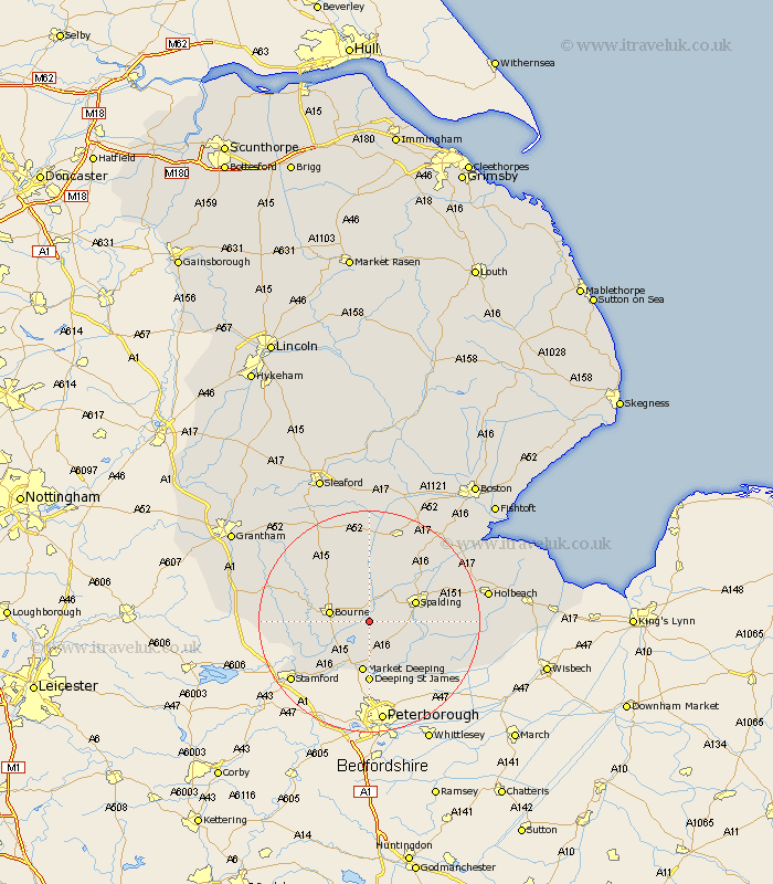
Lincolnshire Map Showing Location of Twenty
District: South Holland
Easting: 515854 Northing: 318350
Latitude: 52.75 Longitude: -0.28
 = Twenty
Easting: 515854 Northing: 318350
Latitude: 52.75 Longitude: -0.28
= Twenty
This Twenty map below is supplied by Google. Use the tools in the top left corner to zoom into street level or zoom out for a road map, you may also need to zoom in to see Twenty on the map. Click and drag the map to move around. If the map fails to load try and refresh your browser or zoom in or out (+ or -).
Update - it seems Google no longer allow people to use their maps for free! This Twenty map sometimes loads and sometimes gives a error. I am working on a solution.
Closest 30 Towns or Cities to Twenty (Population over 500)
Langfoft 6.5km Langtoft 6.5km Morton 6.72km Thurlby 6.72km Deeping St. Nicholas 6.72km Deeping Saint Nicholas 6.72km Deeping St Nicholas 6.72km Bourne 6.98km Bourn 6.98km Baston 7.15km Spalding 8.68km Rippingale 9.3km Market Deeping 9.33km Pinchbeck 10.55km Deeping St James 11.12km Deeping St. James 11.12km Deeping Saint James 11.12km Cowbit 11.37km Pointon 11.62km Crowland 12.9km Croyland 12.9km Surfleet 13.69km Leverington 13.71km Gosberton 14.28km Uffington 14.3km Quadring 15.16km Folkingham 15.16km Billingborough 15.2km Weston 15.6km Moulton 16.13km