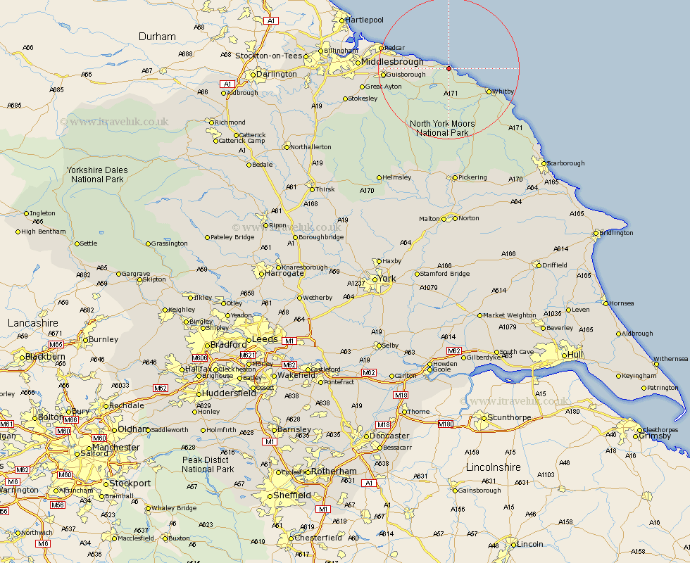
Yorkshire Map Showing Location of Staithes
District: Scarborough
Easting: 478271 Northing: 518070
Latitude: 54.55 Longitude: -0.79
 = Staithes
Easting: 478271 Northing: 518070
Latitude: 54.55 Longitude: -0.79
= Staithes
This Staithes map below is supplied by Google. Use the tools in the top left corner to zoom into street level or zoom out for a road map, you may also need to zoom in to see Staithes on the map. Click and drag the map to move around. If the map fails to load try and refresh your browser or zoom in or out (+ or -).
Update - it seems Google no longer allow people to use their maps for free! This Staithes map sometimes loads and sometimes gives a error. I am working on a solution.
Closest 30 Towns or Cities to Staithes (Population over 500)
Hinderwell 2.53km Loftus 6.04km Brotton 9.41km Skelton-in-Cleveland 12.49km Skelton 12.49km Whitby 12.56km Saltburn by the Sea 12.97km Saltburn-by-the-Sea 12.97km Saltburn 12.97km Sleights 13.82km Marske 15.38km Marske by the Sea 15.38km Marske-by-the-Sea 15.38km Guisborough 16.91km Hawsker 18.31km Redcar 18.46km Eston 20.01km Fylingdales 22.35km Great Ayton 22.91km Middlebrough 23.29km Middlesbrough 23.29km Middlesborough 23.29km South Bank on Tees 23.29km South Bank in Normanby 23.29km South Bank-on-Tees 23.29km South Bank 23.29km Grangetown 23.49km Ingleby 23.98km Great Broughton 26.84km Stokesley 28.12km