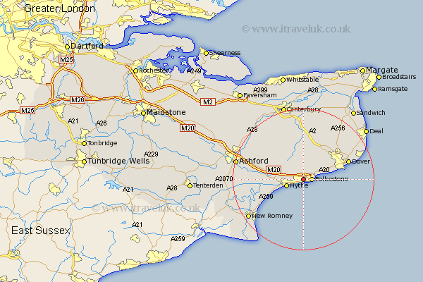
Kent Map Showing Location of Shorncliffe Camp
District: Shepway
Easting: 620593 Northing: 136332
Latitude: 51.08 Longitude: 1.15
 = Shorncliffe Camp
Easting: 620593 Northing: 136332
Latitude: 51.08 Longitude: 1.15
= Shorncliffe Camp
This Shorncliffe Camp map below is supplied by Google. Use the tools in the top left corner to zoom into street level or zoom out for a road map, you may also need to zoom in to see Shorncliffe Camp on the map. Click and drag the map to move around. If the map fails to load try and refresh your browser or zoom in or out (+ or -).
Update - it seems Google no longer allow people to use their maps for free! This Shorncliffe Camp map sometimes loads and sometimes gives a error. I am working on a solution.
Closest 30 Towns or Cities to Shorncliffe Camp (Population over 500)
Hawkinge 2.19km Folkstone 2.33km Folkestone 2.33km Hythe 5.01km Lyminge 5.95km Swingfield 6.03km Elham 7.77km Alkham 8.05km Lympne 8.36km River 9.86km Lydden 10.18km Sellindge 10.64km Sellinge 10.64km Temple Ewell 11.02km Ewell 11.02km Coldred 11.61km Brabourne 11.86km Shepherdswell 12.55km Sibertswold 12.55km Stelling 12.55km Dymchurch 12.84km Smeeth 13.33km Dover 13.74km St Margarets 13.8km St. Margaret's at Cliffe 13.8km Saint Margaret's at Cliffe 13.8km St. Margaret at Cliffe 13.8km St Margaret's at Cliffe 13.8km Saint Margarets 13.8km St. Margarets 13.8km