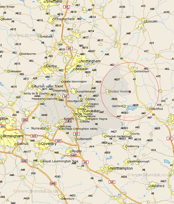
Leicestershire Map Showing Location of Sewstern
District: Melton
Easting: 488826 Northing: 319639
Latitude: 52.77 Longitude: -0.68
 = Sewstern
Easting: 488826 Northing: 319639
Latitude: 52.77 Longitude: -0.68
= Sewstern
This Sewstern map below is supplied by Google. Use the tools in the top left corner to zoom into street level or zoom out for a road map, you may also need to zoom in to see Sewstern on the map. Click and drag the map to move around. If the map fails to load try and refresh your browser or zoom in or out (+ or -).
Update - it seems Google no longer allow people to use their maps for free! This Sewstern map sometimes loads and sometimes gives a error. I am working on a solution.
Closest 30 Towns or Cities to Sewstern (Population over 500)
Wymondham 3.84km Waltham 8.68km Waltham on the Wolds 8.68km Waltham-on-the-Wolds 8.68km Eaton 11.63km Scalford 12.87km Melton Mowbray 13.46km Stathern 14.54km Somerby 15.02km Abkettley 15.8km Ab Kettleby 15.8km Hose 16.34km Redmile 16.77km Twyford 19.25km Frisby-on-the-Wreak 19.43km Frisby 19.43km Frisby on the Wreak 19.43km Gaddesby 20.47km Hoby 21.63km Bottesford 21.83km Rearsby 24.21km Billesdon 25.05km Queniborough 25.33km Queniboro 25.33km Hallaton 26.13km Houghton 26.21km Houghton-on-the-Hill 26.21km Houghton on the Hill 26.21km Syston 27.43km Wymeswold 28.09km