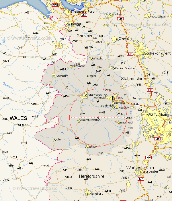
Shropshire Map Showing Location of Presthope
District: Bridgnorth
Easting: 358206 Northing: 296759
Latitude: 52.57 Longitude: -2.62
 = Presthope
Easting: 358206 Northing: 296759
Latitude: 52.57 Longitude: -2.62
= Presthope
This Presthope map below is supplied by Google. Use the tools in the top left corner to zoom into street level or zoom out for a road map, you may also need to zoom in to see Presthope on the map. Click and drag the map to move around. If the map fails to load try and refresh your browser or zoom in or out (+ or -).
Update - it seems Google no longer allow people to use their maps for free! This Presthope map sometimes loads and sometimes gives a error. I am working on a solution.
Closest 30 Towns or Cities to Presthope (Population over 500)
Much Wenlock 5.83km Cressage 7.41km Ditton Priors 8.15km Rushbury 8.75km Broseley 10.59km Barrow Bridge 10.79km Barrow 10.79km Berrington 10.84km Church Stretton 12.53km Ironbridge 12.55km Condover 12.92km Diddlebury 13.02km Bridgnorth 14.02km Baystonhill 14.31km Madeley 14.43km Dawley 15.04km Wrockwardine 15.2km Wellington 16.29km Telford 16.45km Worfield 17km Hadley 17.34km Ketley 17.34km Shrewsbury 18.44km Rodington 18.53km Bitterley 18.67km Hanwood 18.72km Great Hanwood 18.72km Oakengates 19.31km Wistanstow 19.31km Trench 19.51km