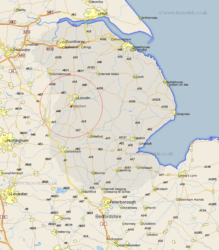
Lincolnshire Map Showing Location of Hykeham
Population: 11538
District: North Kesteven
Easting: 494657 Northing: 366106
Latitude: 53.18 Longitude: -0.58
 = Hykeham
District: North Kesteven
Easting: 494657 Northing: 366106
Latitude: 53.18 Longitude: -0.58
= Hykeham
This Hykeham map below is supplied by Google. Use the tools in the top left corner to zoom into street level or zoom out for a road map, you may also need to zoom in to see Hykeham on the map. Click and drag the map to move around. If the map fails to load try and refresh your browser or zoom in or out (+ or -).
Update - it seems Google no longer allow people to use their maps for free! This Hykeham map sometimes loads and sometimes gives a error. I am working on a solution.
Closest 30 Towns or Cities to Hykeham (Population over 500)
Thorpe-on-the-Hill 3.33km Thorpe on the Hill 3.33km Thorpe 3.33km Waddington 3.81km Aubourn 4.32km Skellingthorpe 5.98km Lincoln 6.48km Eagle 6.66km Branston 7.77km Heighington 7.99km Bassingham 8.13km Washingborough 8.61km Swinderby 8.61km Wellingore 9.85km North Scarle 10.16km Saxilby 10.28km Navenby 10.28km Potter Hanworth 11.11km Nocton 11.26km Nettleham 11.41km Reepham 11.43km Fiskerton 11.43km Cherry Willingham 11.88km Dunston 12.77km Sudbrooke 12.83km Scampton 13.02km Scrampton 13.02km Welbourn 13.16km Metheringham 13.43km Scothern 14.22km