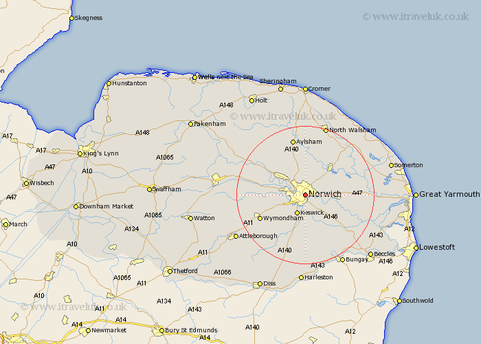
Norfolk Map Showing Location of Norwich
Population: 172582
Area Size (ha): 4887
District: Norwich
Easting: 623282 Northing: 309101
Latitude: 52.63 Longitude: 1.3
 = Norwich
Area Size (ha): 4887
District: Norwich
Easting: 623282 Northing: 309101
Latitude: 52.63 Longitude: 1.3
= Norwich
This Norwich map below is supplied by Google. Use the tools in the top left corner to zoom into street level or zoom out for a road map, you may also need to zoom in to see Norwich on the map. Click and drag the map to move around. If the map fails to load try and refresh your browser or zoom in or out (+ or -).
Update - it seems Google no longer allow people to use their maps for free! This Norwich map sometimes loads and sometimes gives a error. I am working on a solution.
Closest 30 Towns or Cities to Norwich (Population over 500)
Thorpe next Norwich 3.37km Thorpe 3.37km Thorpe St Andrew 3.37km Thorpe Saint Andrew 3.37km Thorpe Episcopi 3.37km Thorpe St. Andrew 3.37km Hellesdon 3.38km Spixworth 4.34km Cringleford 5.01km Horsham St. Faith 5.67km Horsham Saint Faith 5.67km Horsham 5.67km Horsham St Faith 5.67km Costessey 5.92km Horsford 6.5km Drayton 6.74km Great Plumstead 7km Rackheath 7.15km Swardeston 8.14km Taverham 8.7km Hethersett 8.7km Brundall 9.19km Stoke Holy Cross 9.26km Hainford 9.27km Haynford 9.27km Salhouse 9.63km Poringland 9.86km Horstead 9.87km Wroxham 10.02km Blofield 10.29km