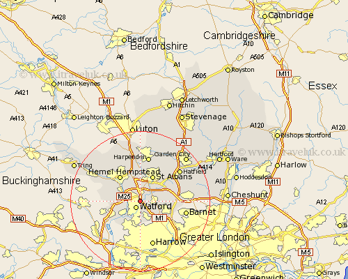
Hertfordshire Map Showing Location of Garston
District: Watford
Easting: 511752 Northing: 199570
Latitude: 51.68 Longitude: -0.38
 = Garston
Easting: 511752 Northing: 199570
Latitude: 51.68 Longitude: -0.38
= Garston
This Garston map below is supplied by Google. Use the tools in the top left corner to zoom into street level or zoom out for a road map, you may also need to zoom in to see Garston on the map. Click and drag the map to move around. If the map fails to load try and refresh your browser or zoom in or out (+ or -).
Update - it seems Google no longer allow people to use their maps for free! This Garston map sometimes loads and sometimes gives a error. I am working on a solution.
Closest 30 Towns or Cities to Garston (Population over 500)
Watford 2.17km Aldenham 2.95km Abbots Langley 2.95km Radlett 4.6km Kings Langley 4.96km Bushey 6.01km Sarratt 6.89km Chipperfield 7.14km Croxley Green 7.22km Chorleywood 7.83km London Olney 7.83km London Colney 7.83km Rickmansworth 8km Shenley 8.04km St. Albans 8.18km Saint Albans 8.18km St Albans 8.18km Borehamwood 8.86km Elstree 8.86km Hemel Hempstead 9.38km North Mymms 9.91km Colney Heath 10.74km Sandridge 10.91km Bovingdon 10.98km Redbourn 11.12km Harpenden 13.18km Berkhampstead 13.67km Berkhamsted 13.67km Great Gaddesden 13.72km Hatfield 14.23km