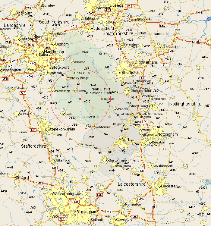
Derbyshire Map Showing Location of Earl Sterndale
District: Derbyshire Dales
Easting: 408905 Northing: 367031
Latitude: 53.2 Longitude: -1.87
 = Earl Sterndale
Easting: 408905 Northing: 367031
Latitude: 53.2 Longitude: -1.87
= Earl Sterndale
This Earl Sterndale map below is supplied by Google. Use the tools in the top left corner to zoom into street level or zoom out for a road map, you may also need to zoom in to see Earl Sterndale on the map. Click and drag the map to move around. If the map fails to load try and refresh your browser or zoom in or out (+ or -).
Update - it seems Google no longer allow people to use their maps for free! This Earl Sterndale map sometimes loads and sometimes gives a error. I am working on a solution.
Closest 30 Towns or Cities to Earl Sterndale (Population over 500)
Buxton 6.48km Tideswell 9.96km Middleton 10.66km Great Longstone 11.7km Longstone 11.7km Youlgreave 11.71km Chapel en le Frith 13.16km Bakewell 13.32km Bradwell 15.12km Eyam 16.21km Stoney Middleton 16.22km Stony Middleton 16.22km Winster 16.24km Castleton 16.25km Whaley Bridge 16.73km Baslow 17.05km Grindleford Bridge 18.08km Grindleford 18.08km Darley Dale 18.15km Hope 18.39km New Mills 18.83km Hathersage 19.39km Brassington 19.42km Bamford 20.66km Bonsall 21.04km Hayfield 21.12km Ashbourne 22.24km Cromford 22.89km Matlock Bath 23.3km Matlock 23.43km