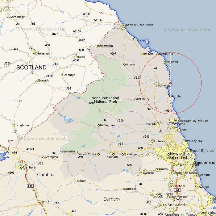
Northumberland Map Showing Location of Boulmer
District: Alnwick
Easting: 426374 Northing: 613724
Latitude: 55.42 Longitude: -1.58
 = Boulmer
Easting: 426374 Northing: 613724
Latitude: 55.42 Longitude: -1.58
= Boulmer
This Boulmer map below is supplied by Google. Use the tools in the top left corner to zoom into street level or zoom out for a road map, you may also need to zoom in to see Boulmer on the map. Click and drag the map to move around. If the map fails to load try and refresh your browser or zoom in or out (+ or -).
Update - it seems Google no longer allow people to use their maps for free! This Boulmer map sometimes loads and sometimes gives a error. I am working on a solution.
Closest 30 Towns or Cities to Boulmer (Population over 500)
Alnmouth 2.14km Lesbury 4.27km Lisburg 4.27km Alnwick 7.6km Almwick 7.6km Embleton 7.7km Warkworth 7.71km Shilbottle 8.41km Amble 9.27km East Chevington 14.83km Beadnell 15.15km Swarland 16.07km East Thirston 16.13km Thirston 16.13km Felton 16.57km North Sunderland 17.49km Longframlington 19.49km Ellington 22.26km Lynemouth 22.79km Rothbury 22.89km Longhorsley 23.46km Belford 25.75km Hebron 26.71km Newbiggin by the Sea 26.82km Newbiggin-by-the-Sea 26.82km Pegswood 27.98km Ashington 28.11km Morpeth 28.51km Wooler 29.29km Hepscott 29.95km