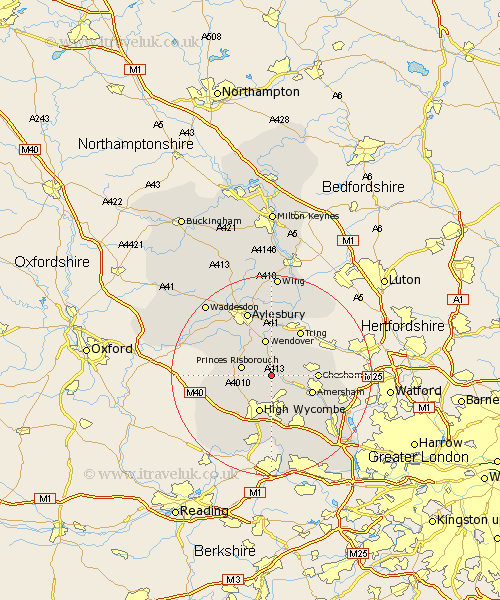
Buckinghamshire Map Showing Location of Prestwood
Population: 7697
Area Size (ha): 247
District: Chiltern
Easting: 487527 Northing: 200949
Latitude: 51.7 Longitude: -0.73
 = Prestwood
Area Size (ha): 247
District: Chiltern
Easting: 487527 Northing: 200949
Latitude: 51.7 Longitude: -0.73
= Prestwood
This Prestwood map below is supplied by Google. Use the tools in the top left corner to zoom into street level or zoom out for a road map, you may also need to zoom in to see Prestwood on the map. Click and drag the map to move around. If the map fails to load try and refresh your browser or zoom in or out (+ or -).
Update - it seems Google no longer allow people to use their maps for free! This Prestwood map sometimes loads and sometimes gives a error. I am working on a solution.
Closest 30 Towns or Cities to Prestwood (Population over 500)
Great Missenden 2.3km Lee 3.91km Hughenden 5.56km Great Kimble 5.9km Kimble 5.9km Little Missenden 5.9km Hazlemere 6.02km Princes Risborough 6.03km Ellesborough 6.54km Bradenham 7.21km Wendover 7.5km Chepping 7.76km High Wycombe 7.76km Wycombe 7.76km West Wycombe 8.73km Longwick 8.85km Amersham 8.85km Chesham 9.19km Halton 9.26km Weston Turville 9.33km Bledlow 9.37km Radnage 9.38km Stoke Mandeville 9.88km Penn 9.88km Aston Clinton 11.18km Buckland 11.18km Flackwell Heath 11.35km Stokenchurch 12.77km Latimer 12.77km Little Marlow 12.98km