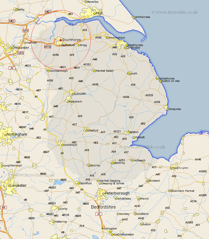
Lincolnshire Map Showing Location of Scunthorpe
Population: 74743
Area Size (ha): 2576
Easting: 489362 Northing: 410512
Latitude: 53.58 Longitude: -0.65
 = Scunthorpe
Area Size (ha): 2576
Easting: 489362 Northing: 410512
Latitude: 53.58 Longitude: -0.65
= Scunthorpe
This Scunthorpe map below is supplied by Google. Use the tools in the top left corner to zoom into street level or zoom out for a road map, you may also need to zoom in to see Scunthorpe on the map. Click and drag the map to move around. If the map fails to load try and refresh your browser or zoom in or out (+ or -).
Update - it seems Google no longer allow people to use their maps for free! This Scunthorpe map sometimes loads and sometimes gives a error. I am working on a solution.
Closest 30 Towns or Cities to Scunthorpe (Population over 500)
Bottesford 3.71km Flixborough 4.31km Gunness 5.5km Gunhouse 5.5km Messingham 5.56km Keadby 5.8km Appleby 6.63km Broughton 6.86km Burringham 6.86km West Butterwick 7.57km Burton upon Stather 7.73km Burton 7.73km Winterton 8.11km Scawby 9.5km Crowle 11.16km Scotter 11.18km Winteringham 11.59km Brigg 11.61km Belton 11.61km Hibaldstow 12.05km Wrawby 12.24km Scotton 12.97km Epworth 13.27km Kirton 13.38km Kirton in Lindsey 13.38km Owston 13.54km Owston Ferry 13.54km South Ferriby 13.56km Haxey 16.45km Barnetby le Wold 16.61km