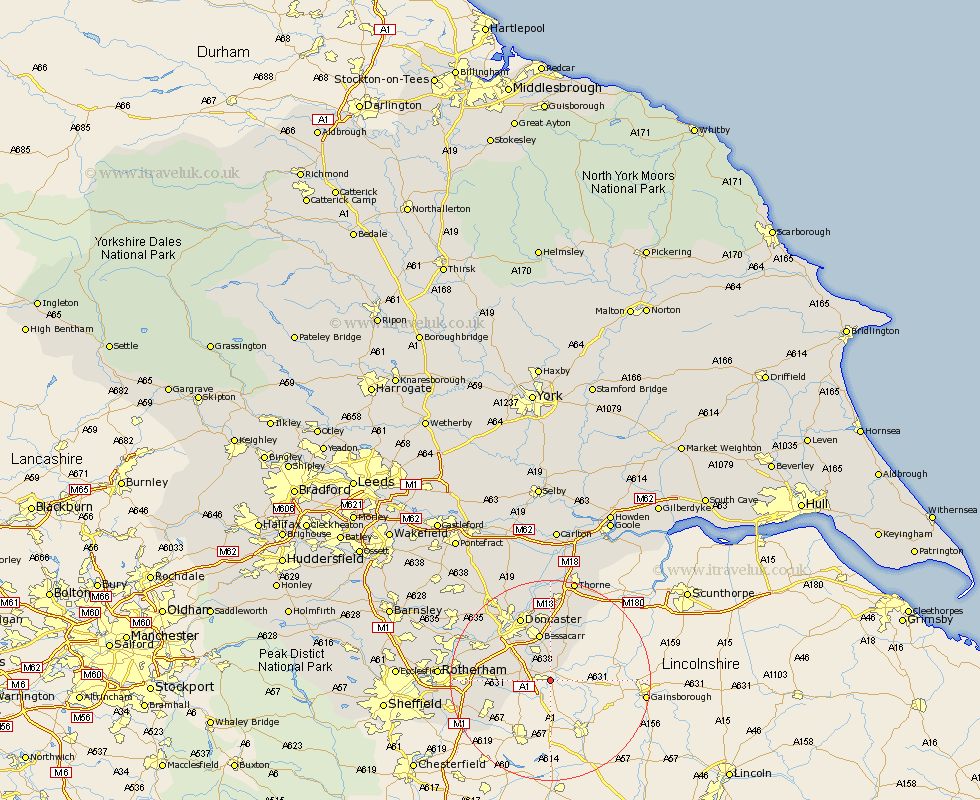
Yorkshire Map Showing Location of Bawtry
Population: 2628
Area Size (ha): 99
District: Doncaster
Easting: 464240 Northing: 391559
Latitude: 53.42 Longitude: -1.03
 = Bawtry
Area Size (ha): 99
District: Doncaster
Easting: 464240 Northing: 391559
Latitude: 53.42 Longitude: -1.03
= Bawtry
This Bawtry map below is supplied by Google. Use the tools in the top left corner to zoom into street level or zoom out for a road map, you may also need to zoom in to see Bawtry on the map. Click and drag the map to move around. If the map fails to load try and refresh your browser or zoom in or out (+ or -).
Update - it seems Google no longer allow people to use their maps for free! This Bawtry map sometimes loads and sometimes gives a error. I am working on a solution.
Closest 30 Towns or Cities to Bawtry (Population over 500)
Austerfield 2.88km Tickhill 5.52km Rossington 5.99km Finningley 6.47km Auckley 9.33km Cantley 9.33km Wadsworth 9.52km Wadworth 9.52km Bessacarr 9.7km Maltby 11.05km Braithwell 11.2km Woodsetts 11.54km Dinnington 12.37km Anston 12.51km Fleckney 12.97km Armthorpe 13.02km Conisborough 13.36km Conisbrough 13.36km Warmsworth 13.58km Doncaster 14.09km Sprotboro 14.41km Sprotbrough 14.41km Bentley 15.1km Kirk Sandall 15.19km Bramley 15.46km Brampton en le Morthern 15.91km Brampton 15.91km Brampton en le Morthen 15.91km Todwick 16.17km Thorpe Salvin 16.48km