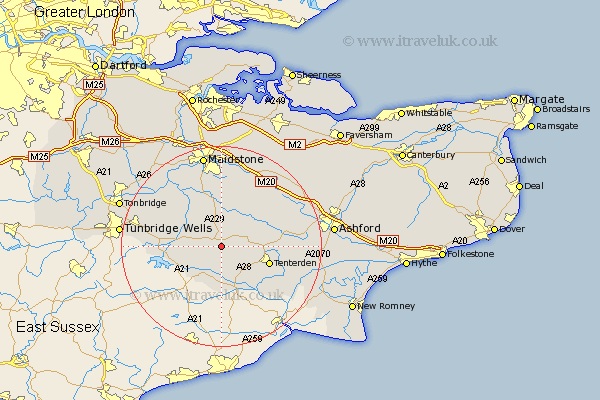
Kent Map Showing Location of Sissinghurst
District: Tunbridge Wells
Easting: 579684 Northing: 136602
Latitude: 51.1 Longitude: 0.57
 = Sissinghurst
Easting: 579684 Northing: 136602
Latitude: 51.1 Longitude: 0.57
= Sissinghurst
This Sissinghurst map below is supplied by Google. Use the tools in the top left corner to zoom into street level or zoom out for a road map, you may also need to zoom in to see Sissinghurst on the map. Click and drag the map to move around. If the map fails to load try and refresh your browser or zoom in or out (+ or -).
Update - it seems Google no longer allow people to use their maps for free! This Sissinghurst map sometimes loads and sometimes gives a error. I am working on a solution.
Closest 30 Towns or Cities to Sissinghurst (Population over 500)
Cranbrook 2.98km Frittenden 3.88km Biddenden 4.66km Beneden 5.68km Benenden 5.68km Staplehurst 6.03km Headcorn 6.56km Goudhurst 8.15km Marden 8.75km Hawkhurst 8.76km Rolvenden 8.76km Smarden 8.95km Sandhurst 9.26km Horsmonden 9.49km Tenterden 10.05km High Halden 10.64km Sutton Valence 11.18km Brenchley 12.21km Ulcombe 12.55km Hunton 12.55km Lamberhurst 12.94km Boughton Monchelsea 13.18km Linton 13.44km Bethersden 14.09km Woodchurch 14.45km Wittersham 14.51km Paddock Wood 14.79km Egerton 14.87km Langley 14.87km Loose 15.23km