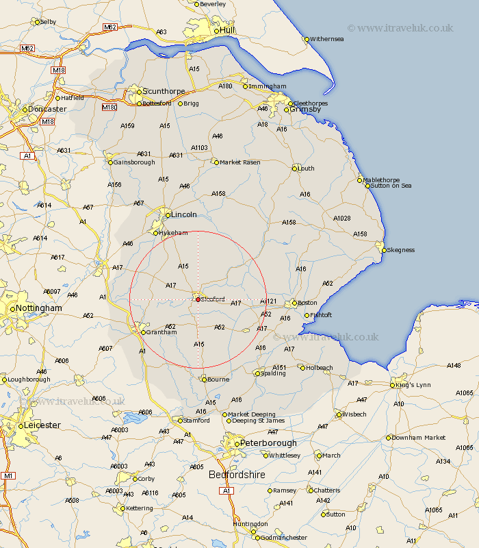
Lincolnshire Map Showing Location of Sleaford
Population: 10216
Area Size (ha): 300
District: North Kesteven
Easting: 507403 Northing: 344116
Latitude: 52.99 Longitude: -0.41
 = Sleaford
Area Size (ha): 300
District: North Kesteven
Easting: 507403 Northing: 344116
Latitude: 52.99 Longitude: -0.41
= Sleaford
This Sleaford map below is supplied by Google. Use the tools in the top left corner to zoom into street level or zoom out for a road map, you may also need to zoom in to see Sleaford on the map. Click and drag the map to move around. If the map fails to load try and refresh your browser or zoom in or out (+ or -).
Update - it seems Google no longer allow people to use their maps for free! This Sleaford map sometimes loads and sometimes gives a error. I am working on a solution.
Closest 30 Towns or Cities to Sleaford (Population over 500)
Heasingham 2.64km Leasingham 2.64km Ruskington 4.79km Buskington 4.79km Cranwell 5.84km Brauncewell 6.49km Ancaster 8.77km Heckington 8.98km Hale 9.75km Great Hale 9.75km Helpringham 9.94km Bloxholme 10.02km Bloxholm 10.02km Digby 10.42km Scopwick 11.88km Fulbeck 12.42km Welbourn 12.42km Caythorpe 12.98km Billinghay 13.11km Billingborough 13.27km Navenby 13.84km Folkingham 14.09km Ropsley 14.17km Belton 14.37km Wellingore 14.45km Martin 14.65km Metheringham 15.58km Pointon 16.74km Dunston 17.44km Donington 17.48km