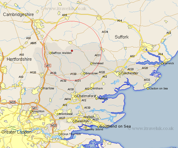
Essex Map Showing Location of Steeple Bumpstead
Population: 1481
District: Braintree
Easting: 568040 Northing: 240090
Latitude: 52.03 Longitude: 0.45
 = Steeple Bumpstead
District: Braintree
Easting: 568040 Northing: 240090
Latitude: 52.03 Longitude: 0.45
= Steeple Bumpstead
This Steeple Bumpstead map below is supplied by Google. Use the tools in the top left corner to zoom into street level or zoom out for a road map, you may also need to zoom in to see Steeple Bumpstead on the map. Click and drag the map to move around. If the map fails to load try and refresh your browser or zoom in or out (+ or -).
Update - it seems Google no longer allow people to use their maps for free! This Steeple Bumpstead map sometimes loads and sometimes gives a error. I am working on a solution.
Closest 30 Towns or Cities to Steeple Bumpstead (Population over 500)
Ridgwell 5.99km Ridgewell 5.99km Great Sampford 6.53km Toppesfield 6.8km Finchingfield 7.41km Great Yeldham 8.19km Yeldham 8.19km Radwinter 8.8km Ashdon 9.31km Wethersfield 9.54km Wenbech 9.85km Gwimbach 9.85km Wimbish 9.85km Winebisc 9.85km Wymbyshe 9.85km Winbeche 9.85km Wimbeis 9.85km Thaxted 10.88km Great Bardfield 11.35km Shalford 11.64km Castle Hedingham 11.68km Sible Hedingham 11.76km Saffron Walden 13.81km Gosfield 14.39km Debden 14.57km Newport 14.78km Halstead 15.6km Littlebury 15.96km Bulmer 16.07km Broxted 16.54km