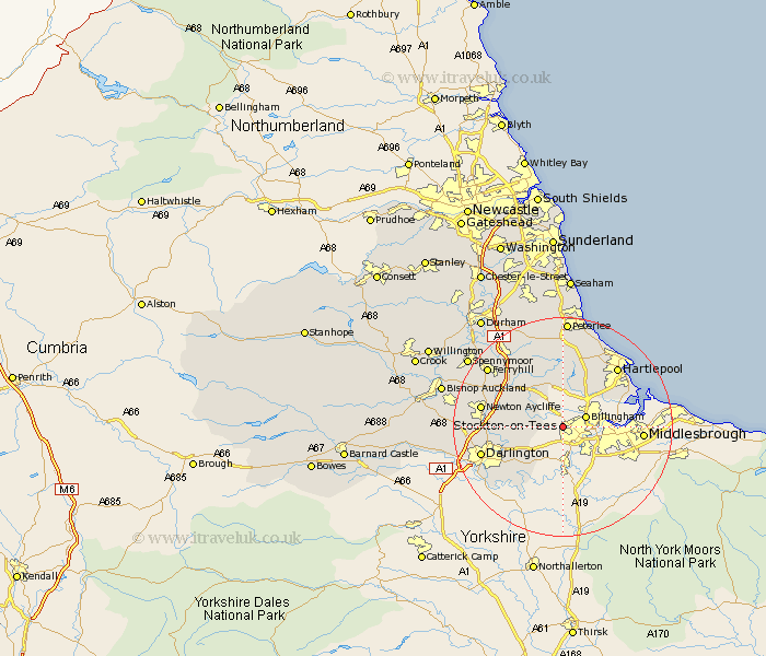
Durham Map Showing Location of Stockton On Tees
Population: 82409
Area Size (ha): 2060
Easting: 441578 Northing: 521073
Latitude: 54.58 Longitude: -1.36
 = Stockton On Tees
Area Size (ha): 2060
Easting: 441578 Northing: 521073
Latitude: 54.58 Longitude: -1.36
= Stockton On Tees
This Stockton On Tees map below is supplied by Google. Use the tools in the top left corner to zoom into street level or zoom out for a road map, you may also need to zoom in to see Stockton On Tees on the map. Click and drag the map to move around. If the map fails to load try and refresh your browser or zoom in or out (+ or -).
Update - it seems Google no longer allow people to use their maps for free! This Stockton On Tees map sometimes loads and sometimes gives a error. I am working on a solution.
Closest 30 Towns or Cities to Stockton On Tees (Population over 500)
Carlton 2.79km Grindon 4.09km Billingham on Tees 4.09km Billingham 4.09km Billingham-on-Tees 4.09km Stillington 5.27km Eaglescliffe 5.58km Wolviston 6.01km Thornaby-on-Tees 6.66km Thornaby on Tees 6.66km Thornaby 6.66km Egglescliffe 7.42km Sedgefield 8.91km Yarm 9.28km Yarm-on-Tees 9.28km Yarm on Tees 9.28km Greatham 9.69km Elwick 12.08km Fishburn 12.16km Trimdon 13.53km Bishop Middleham 13.78km Newton Aycliffe 14.03km Hartlepool 14.31km Darlington 14.64km Hutton Henry 14.84km Hurworth 15.18km Hart 15.92km Cornforth 16.56km West Cornforth 16.56km Ferryhill 16.69km