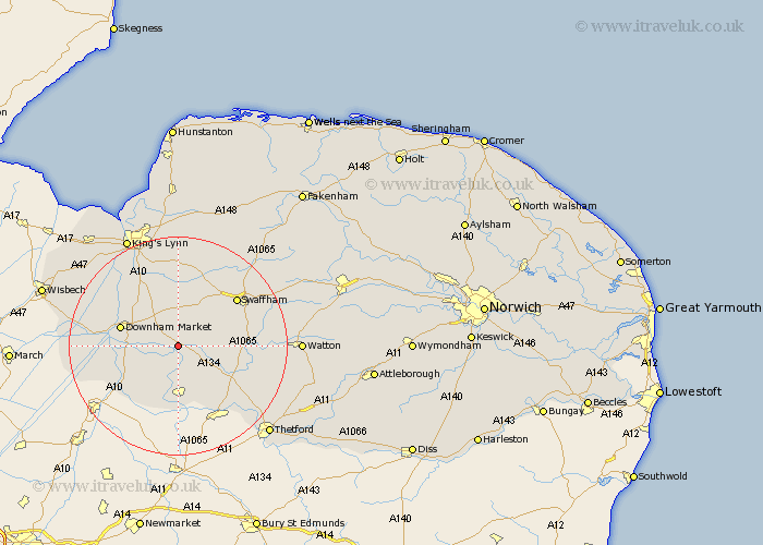
Norfolk Map Showing Location of Stoke Ferry
Population: 896
District: King's Lynn and West Norfolk
Easting: 570549 Northing: 299556
Latitude: 52.57 Longitude: 0.52
 = Stoke Ferry
District: King's Lynn and West Norfolk
Easting: 570549 Northing: 299556
Latitude: 52.57 Longitude: 0.52
= Stoke Ferry
This Stoke Ferry map below is supplied by Google. Use the tools in the top left corner to zoom into street level or zoom out for a road map, you may also need to zoom in to see Stoke Ferry on the map. Click and drag the map to move around. If the map fails to load try and refresh your browser or zoom in or out (+ or -).
Update - it seems Google no longer allow people to use their maps for free! This Stoke Ferry map sometimes loads and sometimes gives a error. I am working on a solution.
Closest 30 Towns or Cities to Stoke Ferry (Population over 500)
Wereham 2.91km Northwold 5.93km Methwold 6km Hilgay 8.1km Feltwell 9.34km Shouldham 9.53km Marham 9.53km Denver 10.3km Southery 10.59km Downham Market 10.79km Mundford 11.68km Runcton 12.16km Runcton Holme 12.16km Hockwold cum Wilton 13.17km Hockwold 13.17km Narborough 13.72km Swaffham 13.73km Watlington 14.31km Weeting 14.64km North Runcton 15.85km Middleton 17.02km Palgrave 18.37km Great Palgrave 18.37km East Winch 18.56km Castle Acre 18.61km Gayton 18.66km Welney 18.87km Ashill 19.5km Outwell 19.93km Necton 20.25km