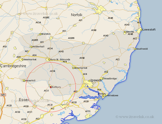
Suffolk Map Showing Location of Sudbury
Population: 19289
Area Size (ha): 534
District: Babergh
Easting: 587470 Northing: 240783
Latitude: 52.03 Longitude: 0.73
 = Sudbury
Area Size (ha): 534
District: Babergh
Easting: 587470 Northing: 240783
Latitude: 52.03 Longitude: 0.73
= Sudbury
This Sudbury map below is supplied by Google. Use the tools in the top left corner to zoom into street level or zoom out for a road map, you may also need to zoom in to see Sudbury on the map. Click and drag the map to move around. If the map fails to load try and refresh your browser or zoom in or out (+ or -).
Update - it seems Google no longer allow people to use their maps for free! This Sudbury map sometimes loads and sometimes gives a error. I am working on a solution.
Closest 30 Towns or Cities to Sudbury (Population over 500)
Great Cornard 2.28km Long Melford 3.89km Great Waldingfield 5.05km Waldingfield 5.05km Lavenham 8.7km Glemsford 8.7km Cavendish 8.81km Boxford 9.31km Clare 11.67km Polstead 11.99km Lawshall 12.98km Cockfield 13.42km Bildeston 14.56km Hundon 14.56km Hitcham 14.69km Hadleigh 14.93km Layham 16.07km Wickhambrook 17.26km Kedington 17.97km Chedburgh 18.49km Bradfield Saint George 19.09km Bradfield 19.09km Bradfield St George 19.09km Bradfield St. George 19.09km Great Bricett 19.44km Rattlesden 19.57km Finborough 20.17km Great Finborough 20.17km Chevington 20.18km Ringshall 20.38km