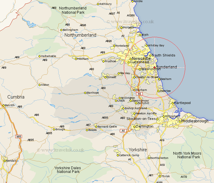
Durham Map Showing Location of Sunderland
Population: 183177
Area Size (ha): 3767
District: Sunderland
Easting: 439529 Northing: 557648
Latitude: 54.91 Longitude: -1.38
 = Sunderland
Area Size (ha): 3767
District: Sunderland
Easting: 439529 Northing: 557648
Latitude: 54.91 Longitude: -1.38
= Sunderland
This Sunderland map below is supplied by Google. Use the tools in the top left corner to zoom into street level or zoom out for a road map, you may also need to zoom in to see Sunderland on the map. Click and drag the map to move around. If the map fails to load try and refresh your browser or zoom in or out (+ or -).
Update - it seems Google no longer allow people to use their maps for free! This Sunderland map sometimes loads and sometimes gives a error. I am working on a solution.
Closest 30 Towns or Cities to Sunderland (Population over 500)
Whitburn 4.7km Marsden 6.19km West Boldon 6.8km Boldon 6.8km Washington New Town 8.63km Washington 8.63km Houghton le Spring 8.71km Seaton 8.74km Jarrow-on-Tyne 8.77km Jarrow 8.77km Jarrow on Tyne 8.77km Seaham 8.85km Seaham Harbour 8.85km Hebburn on Tyne 10.47km Hebburn-on-Tyne 10.47km Hebburn 10.47km Dalton 10.64km Dalton le Dale 10.64km Murton 10.8km Hetton le Hole 11.41km Birtley 12.15km Felling 12.26km South Hetton 12.49km West Rainton 12.95km Chester-le-Street 13.6km Lamesley 13.86km Pittington 13.99km Easington 14.16km Shotton 14.34km Haswell 14.46km